Tag Archives: views

China Wall near Alamo

5 Mar

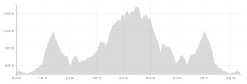
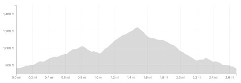
Length: 3.9 miles (roundtrip)
Time: 1.5 hours
Difficulty: Easy
Dogs: No, because part of trail goes into Mt. Diablo State Park where dogs aren’t allowed.
Calories: 600 or so 
Elevation Gain: 667 feet.
Best Season: Winter or spring when not muddy
EBMUD Permit Required:  No
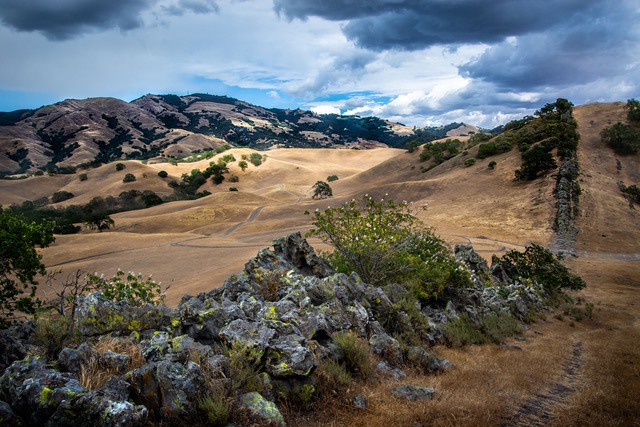
Highlights: China Wall is a very unique and special geological feature in Mt. Diablo State Park!
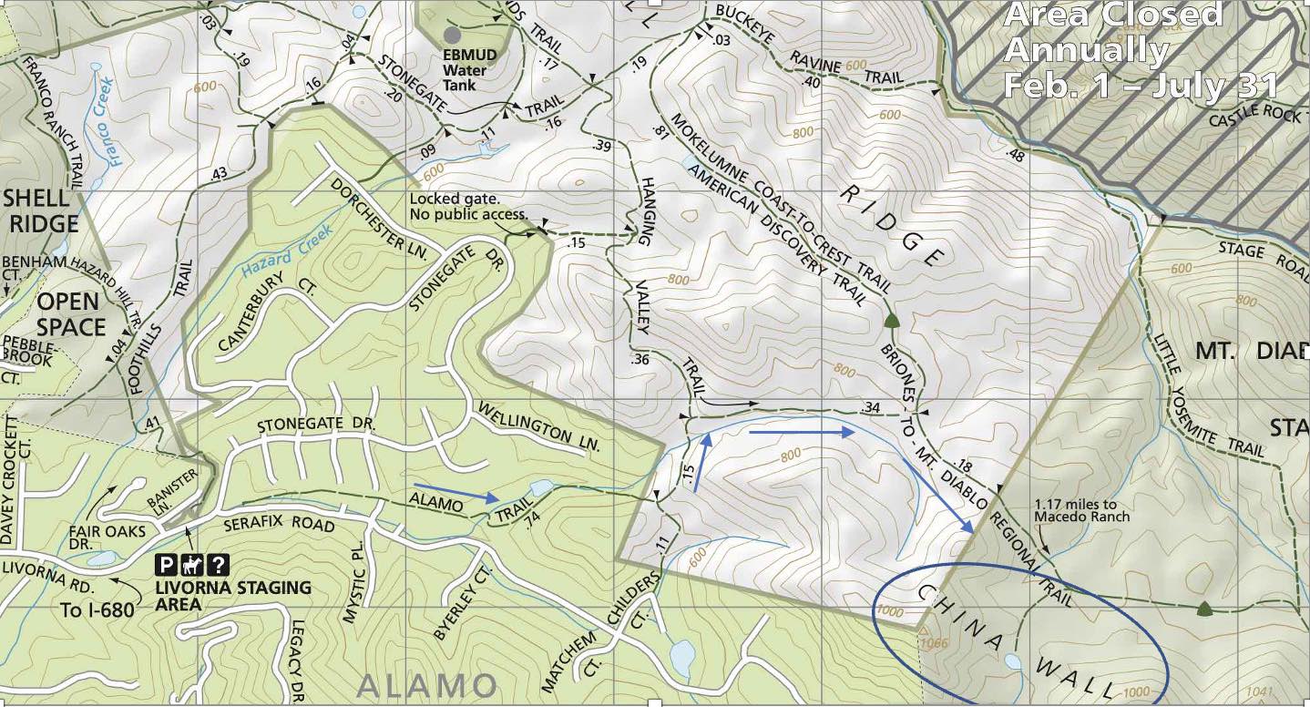
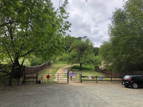
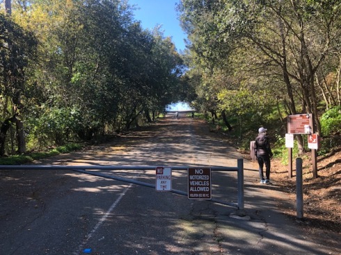
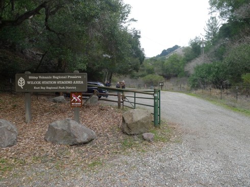
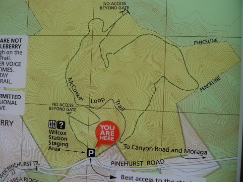
Directions:  Take Highway 680 to Livorna Road. Exit and go east about two miles. Park at Livorna Staging Area.
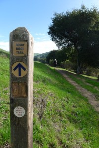
Trailhead:  After parking, look for the Alamo Trail between Stonegate and Serafix Roads.

Over the past few years I’ve been on countless hikes with good friends, including Michael Dawson.  Michael introduced me to this hike and helped author this post.  The beginning of a partnership? I think so.  You may also know Michael as one of the fearless leaders of Save Lafayette Trees.

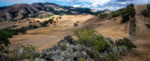
To see the Great Wall of China requires over 15 hours in a plane, but visiting the “China Wall” in Mt. Diablo State Park only requires a 15 min drive to Livorna Staging Area in Alamo! Combined with the 45 min of hiking required, you can be at the Mt. Diablo State Park China Wall in about an hour.  But all kidding aside, the China Wall is a surprising rock formation and one of the most unique geologic features in Mt. Diablo State Park.  Sandstone that was once underwater and level has been thrust 90 degrees and skyward, and now creates a line of rocks up and down the hill that do look just a little like a miniature version of the Great Wall of China.

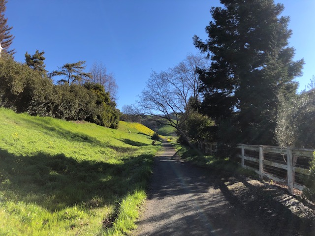
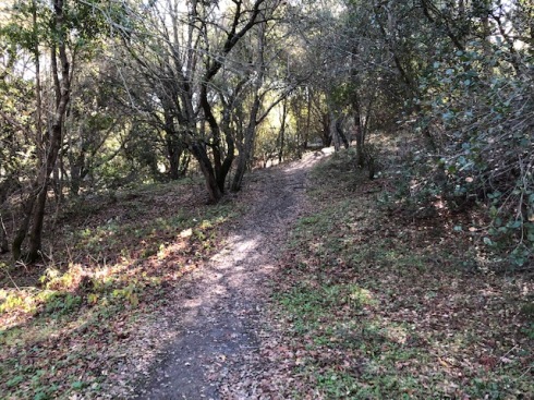
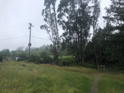
After parking at the Livorna Staging Area, look for the Alamo Trail just to the left of Serafix Road.  

Alamo Trail

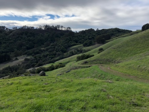
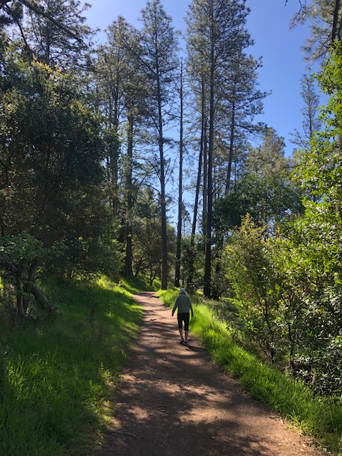
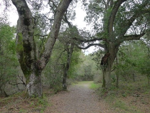
After about ¾ of a mile you will enter the 1,060 acre Diablo Foothills Regional Park, which is best known for Castle Rocks and Shell Ridge. Stay left and past the cattle gate until you reach the Hanging Valley Trail.  Take a right.  Go about a third of a mile until reaching the Briones to Mt. Diablo Regional Trail.  Take another right.   

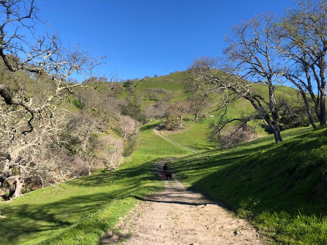
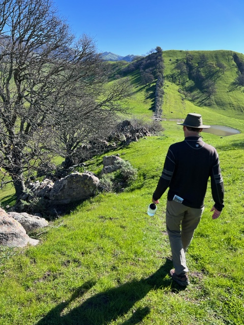
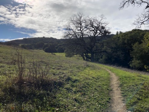
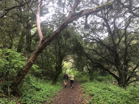
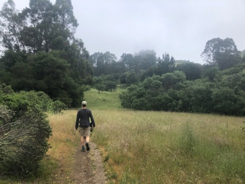
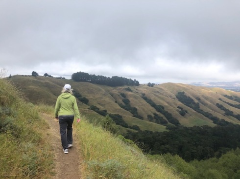
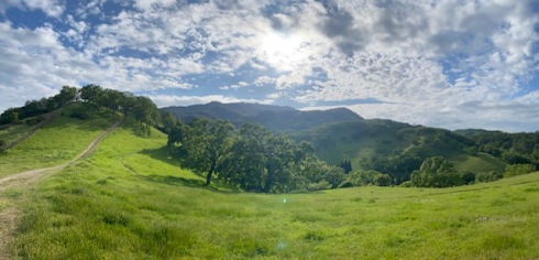
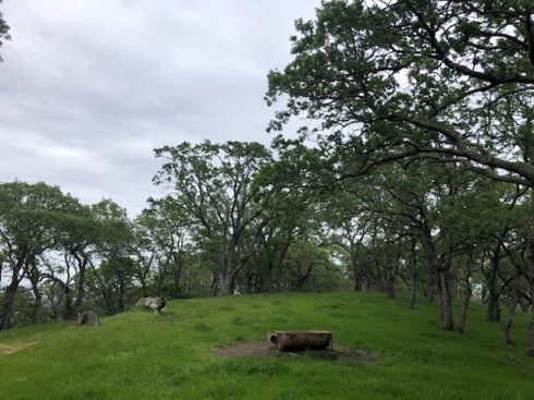
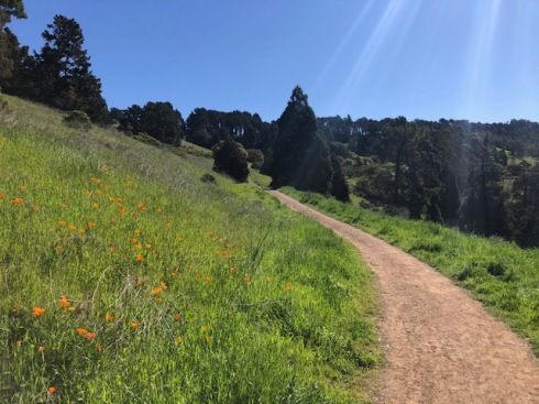
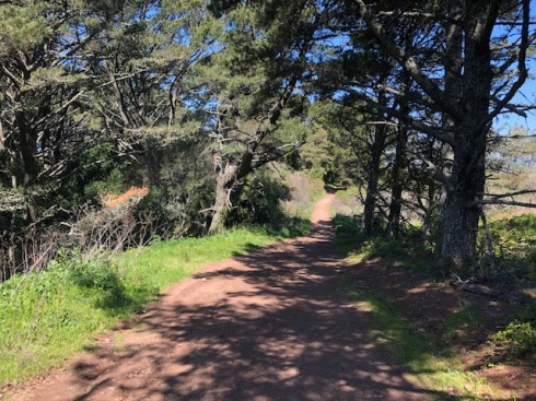
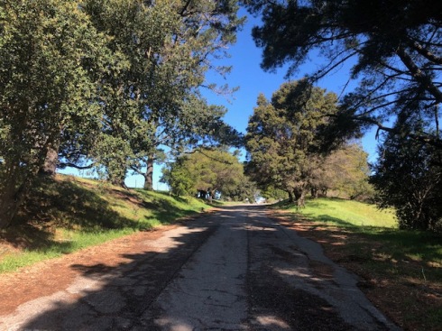
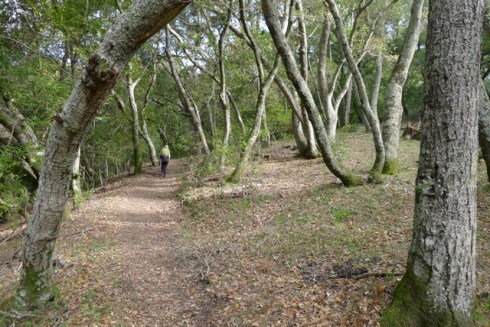
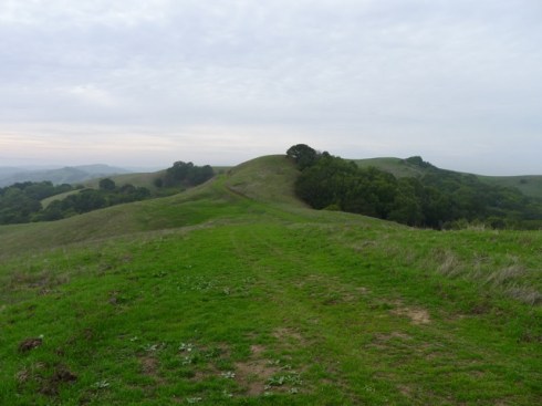
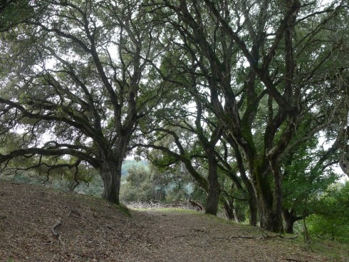
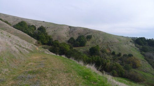
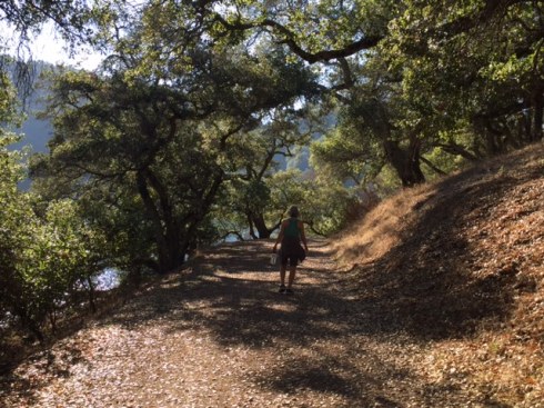
Most of the hike is through open grasslands with scattered valley oaks.  Make sure to bring a hat, water, and sunscreen!

Scattered Valley Oaks

You will soon enter Mt. Diablo State Park and in a little less than half a mile you will reach the China Wall feature.  You won’t be able to miss it! The sandstone rocks form what geologists call a “hogback”, a narrow ridge of eroding rocks that extends like a saddle up both hillsides.  

China Wall with Mt. Diablo in the distance

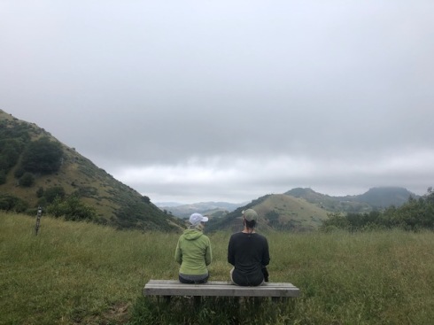
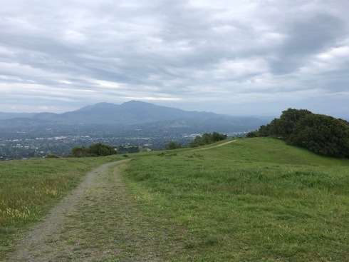
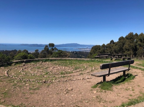
Have fun exploring, taking pictures, rock climbing with kids, taking in the views, etc. and then return the same way you came. A narrow trail extends in both directions – it’s worth the extra effort to explore since some of the best viewpoints are at the highest locations.

Exploring China Wall

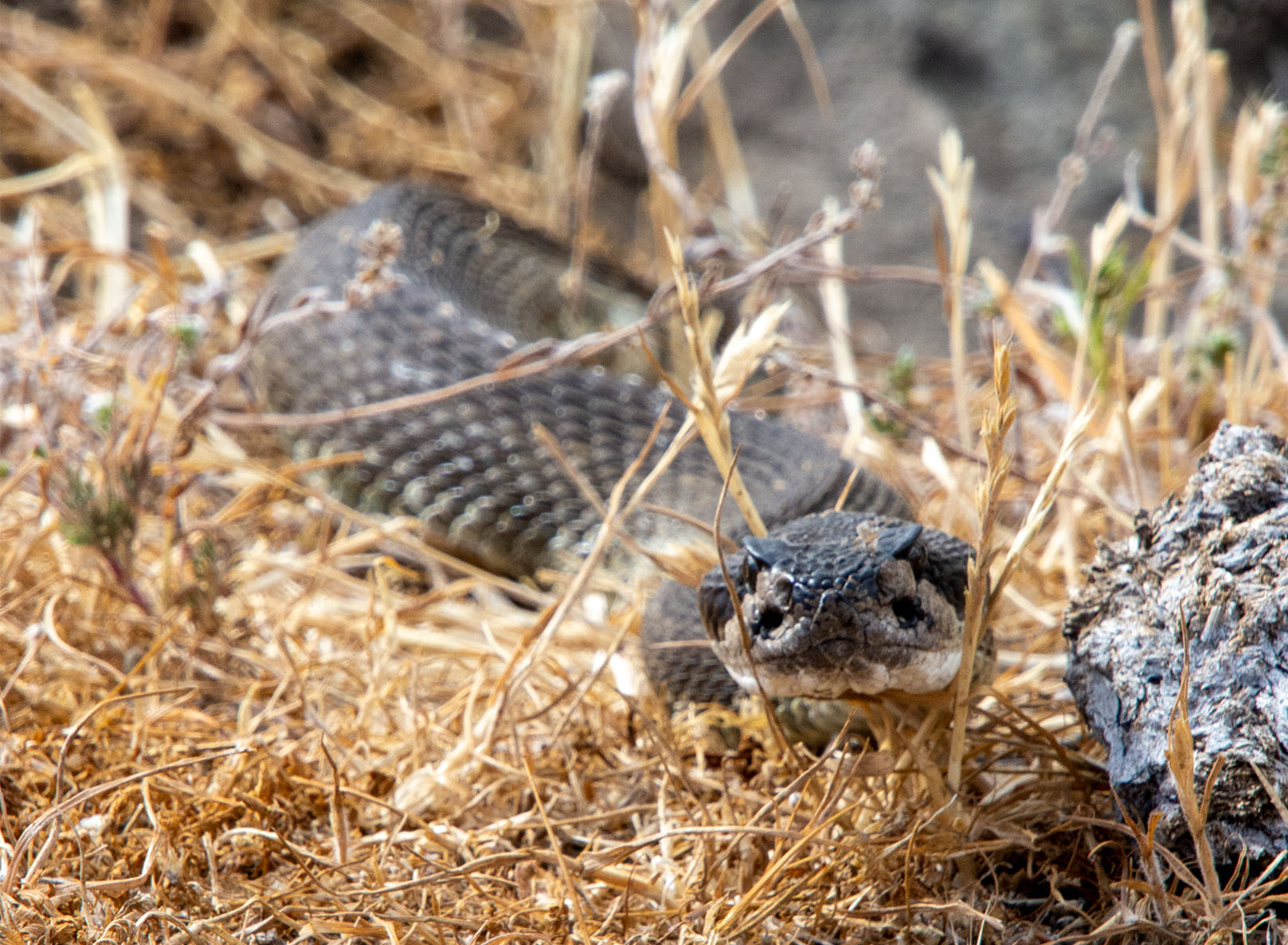
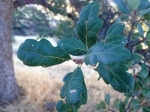
Rock outcrops in Diablo State Park shelter garter and gopher snakes, western fence lizards, southern alligator lizards, tree frogs, and California salamanders. Not sure which of those hang out at China Wall. 

Please keep watch for rattlesnakes that may burrow near the rock outcroppings. On a recent visit, a large rattlesnake was seen absorbing the afternoon sun, too lazy to shake its tail or return to its hole nearby.  

Rattlesnake

If you desire a longer hike, you can take the Foothills Trail from the staging area to the Stonegate Trail, to the Hanging Valley Trail..

It’s worth mentioning that Save Mt. Diablo has played a huge and central role, for over 50 years, expanding the amount of land protected around Mt. Diablo.

De Laveaga Trail to Siesta Valley

12 Feb

Length: 5.9 miles
Time: 2.5 hours
Difficulty: Challenging with several steep sections
Dogs: Not allowed.
Calories: 800-1000 
Elevation Gain: 1635 feet.
Best Season: Winter/spring when it’s cool, sunny and clear, but not muddy
EBMUD Permit Required:  Yes
Highlights:  Leave the crowds behind with a “butt kicker” that has great views of Mt. Diablo over downtown Orinda, and access to the very isolated Siesta Valley and the Grizzly Peak/Tilden Park area.
Directions:  Take Highway 24 to Orinda and exit onto Camino Pablo, going North. Take a U-turn at the first light and head back towards the highway. You’ll see a gravel parking area on the right side before reaching the highway.
Trailhead:  After parking, you’ll see the gate and kiosk at the beginning of the De Laveaga Trail.

The De Laveaga Trail climbs roughly three miles from near downtown Orinda (elevation 460ft) to the Bay Area Ridge Trail & East Bay Skyline Trail adjacent to Grizzly Peak Blvd (elevation almost 1600ft). 

Map of De Laveaga Trail to Siesta Valley and Grizzly Peak Blvd.

The trail is named after the deLaveaga train station, the eastern end of the old California & Nevada Railroad that ran from 1891 until 1904 between Emeryville and Orinda, hauling farm produce and passengers.  On Sundays, trainloads of folks took the train to Orinda to picnic! The station was named after the deLaveaga family & property where the station was located.  Today, the refurbished station is located near the onramp to Highway 24 and a fun place to check out.

Beginning of De Laveaga Trail

The trail starts out as a pleasant single track through a wooded area for maybe half a mile, but soon leaves the trees behind as it connects with a fire road that winds its way up the hill.

Trail opens to meadow and then fire road

Just follow the signs to stay on the trail, and the views get better and better as you climb higher and higher! If you don’t complain about all the climbing at least once, then you’re in better shape than me!  You may encounter cows, but I haven’t yet, and during one section you’ll hike under high voltage power lines.  Not where you want to stop and have a picnic.

View over downtown Orinda

View, higher up the trail, of Mt. Diablo

After some good climbing, and about 1.8 miles, you’ll reach a gate and a sort of pass into the Siesta Valley Recreation Area.  Just past the gate, there is a little trail to the left that goes out to Hump Peak at 1540ft – an excellent view point. Continue into the Siesta Valley. This is the most scenic part of the hike and you might feel like you have a whole hidden valley to yourself! 

Siesta Valley

Located just down the hill is the California Shakespeare Theater (CalShakes).  Seeing a Shakespeare play or other performance there in the summer makes for a wonderful evening.  Just dress warmly!

The trail drops down a ways before making a final climb up to the Skyline Trail, near Tilden Park.  There are scattered groves of eucalyptus trees (that have been thinned) and it is increasingly lush as you approach the summit.

Post for Bay Area Ridge & Skyline Trail

Once you reach the Skyline Trail, I like to take a left until I reach a gate adjacent to Grizzly Peak Blvd.   This is actually called the Scotts Peak Trailhead (or Skyline Gardens Trailhead?) and you can continue on a trail across the street if you want to reach an awesome view point looking out over the Bay.  But normally, I just turn around and head back the way I came.

If you take a right at the Skyline Trail, instead of going left, the trail will take you to Tilden Park.

You can also access Siesta Valley by parking at the Scotts Peak Trailhead and hiking down towards Orinda.

One time my wife and I left our home in Lafayette on foot (Burton Valley), took BART to Orinda, and then hiked the De Laveaga, with backpacks, over the hill all the way to the Claremont Hotel! I love cooking up these types of “urban adventures”! At the hotel, they started telling us about parking our car, but we didn’t have one.

Skyline to Tilden

15 May

Length: 4.3 miles. It’s an out and back so you can decide when to turn around.
Time: 1.5-2 hours
Difficulty: Easy to Medium
Dogs: Yes!
Calories: 600-700
Elevation Gain: 700 feet (starts at 1000 feet and climbs to 1600 feet).
Best Season: Any season.  Good summer hike.
EMBUD Permit Required:  No
Highlights:  The first mile is very lush with a wide range of plants and then great views towards Mount Diablo as you climb towards Tilden Park.  Downside is road noise.
Directions:  Take Highway 24 towards Oakland. Exit at Fish Ranch Road (last exit before tunnel).  Take a left at Fish Ranch Road, cross over the highway, and then take a right on Old Tunnel Road.  After about a third of a mile you’ll reach the Old Tunnel Road Staging Area for Sibley Park.  This is where you park.
Trailhead:  Old Tunnel Road will take a sharp turn, and after the turn you’ll see a trail on the right side of the road heading North.  You’ll also see signs pointing to “Skyline to Tilden” which is what you want.

NOTE: Old Tunnel Road has been closed during the stay-at-home orders, so you need to park and walk up Old Tunnel Road to reach the trail, about a third of a mile.

Most people who go to the Old Tunnel Road Staging Area are using it to access Sibley Volcanic Preserve, but for this hike we’re going to head north instead towards Tilden Park. Look for the signs for “Skyline Trail to Tilden Park”.

The Skyline Trail is a 31-mile continuous path that traverses through six of the East Bay’s most historic and picturesque parks and preserves.  It is one of 1200 designated National Recreation Trails in the U.S.  And it is part of the Bay Area Ridge Trail, a planned 550-mile trail along ridgelines ringing the Bay Area.

The first mile of the trail is surprisingly lush.  This is because the Oakland hills capture extra rain and fog and the east side of the hills have less sun and evaporation than the west side.  You’ll be able to hear Highway 24, but try to imagine you’re hearing a waterfall in the distance.

Lush zone during the first mile of trail

During the first half mile or so you’ll notice many Big Leaf Maple trees, which is quite unusual, because they are normally constrained to riparian zones along creeks.  Along with the maples, this unique zone harbors a multitude of herbaceous flowering plants such as wild strawberry, cinquefoil, forget-me-not, cow parsnip, and others.

Cow parsnip next to the trail

After a mile of hiking you’ll reach Fish Ranch Road. After crossing the road and resuming on the other side, you’ll find that you’re now in a dry grassy scrubland.  It’s worth noticing a single Juniper Tree on the right side soon after crossing.

Beginning of grassy scrubland

A short way further you’ll reach a junction and should stay to the right.  And then soon after that you’ll arrive at the bench shown below with a fantastic view out towards Mt. Diablo.

What a view!

The trail continues up the hillside, next to Grizzly Peak Blvd., with a few switchbacks.  On our hike we noticed a couple people working in a gulley between the trail and water tank with scattered coyote brush. We stopped to talk with them and found out they were part of the CA Native Plant Society and volunteering every week to remove invasive thistle and grasses, to allow native plants to return.  They meet every Sunday morning.

The trail continues on the east side of the hill, separated from the road, and this is my favorite section of the hike.  It’s quiet and very scenic with fantastic views looking out over the Siesta Valley.

View out towards Siesta Valley

After a little over 2 miles you’ll reach an EBMUD gate and see the road up to the left. This is close to Scott’s Peak Trailhead (opposite side of road) and where I usually turn around and return the same way I came.

Grizzly Peak Blvd. and EBUD gate where I normally turn around

You’ll see a fire road heading straight down the hill, which ends at Cal Shakes – a great place to see Shakespeare and other plays during the summer.

If you continue further you’ll soon reach the junction with the De La Veaga Trail, which is an EBMUD trail that winds down to Orinda (permit required).  And if you continue straight you’ll reach the Tilden Steam Train and Seaview Trailhead.

Another option is to cross the street and hike down to the Claremont Canyon Lookout.


Briones Spengler Loop

27 Apr

Length: 6.4 miles
Time: 2.5 hours
Difficulty: Medium
Dogs: Yes!
Calories: ~1000
Elevation Gain: ~1500 feet
Best Season: Winter and spring when the hills are green. Fall can be nice as well.
EMBUD Permit Required:  No
Highlights:  Blue Oak woodland and panoramic views from Briones Crest Trail & Briones Peak
Directions:  From Highway 24 take Pleasant Hill Road exit and head north.  Veer left on Taylor Blvd. Take a left on Withers Avenue. Right on Reliez Valley Road and then you’ll see the Reliez Valley Staging Area on your left.  OR plug “Reliez Valley Staging Area” or “Reliez Valley Trail Head” into your map application.
Trailhead:  At the west end of the small parking lot.

At 6,256 acres, Briones is certainly the largest regional park in the Lamorinda area with multiple points of entry and it’s fun to think that John Muir hiked these hills in the late 1800s.  This staging area and trailhead is especially convenient for anyone living in the Springhill neighborhood of Lafayette, but for others it’s only about a six minute drive from Highway 24 & Pleasant Hill Road (3.5 miles).

Reliez Valley Staging Area

To start the hike head through the gate to begin on the Blue Oak Trail. You’ll ascend through open grasslands with scattered oaks for about a mile until you reach a junction.

Blue Oak Trail (on left) as dusk approaches

You can reach the Spengler Trail either by taking a right on the Blue Oak, up a steep open hill, or continue straight to scramble up the Blue Oak Shortcut, which I prefer.

Blue Oak leaf

Either way, when you reach the Spengler Trail go right.  You’ll be walking through a Blue Oak woodland.  This is the only chance you’ll get to see Blue Oaks on this hike, which are more common the farther you go East. They are the most heat and drought tolerant of our native oaks, and the leaves develop a bluish cast as we progress into summer and fall.  You can identify them by looking closely at one or more of the leaves, which are deciduous, smooth edged, and shallowly lobed (see picture).

Blue Oak woodland at intersection of Spengler and Blue Oak Trail

Ivan Dickson Memorial Trail marker

Continue following the wooded Spengler Trail.  You’ll reach post/marker 49, marker 48, and then marker 46.  You’ll notice on marker 46 “Ivan Dickson Memorial Loop Trail.” This is an 11.7 mile grand loop of Briones Regional Park, in honor of Ivan Dickson.  The loop includes going out to Ivan Dickson Point (near Bear Creek Road) and seeing a special stone bench in his honor.  A passionate hiker and lifelong member of the Berkeley Hiking Club, he left $427K in 1993 for a special gift fund to support a volunteer trail maintenance program that will allow future generations to “take good care of the trails” in perpetuity.

After thanking Ivan, continue straight (angling to the left) on the Spengler Trail. Do not take the Diablo View Trail to the right. You’ll begin to drop into a more lush canyon with the Alhambra Creek (marker 37).  The creek starts in Briones and flows about six miles, through downtown Martinez, and into the Carquinez Strait.

Checking out some lupine near Alhambra Creek

Climb out of the canyon until you reach the Old Briones Road Trail (marker 24), where you’ll take a left.

This is in the vicinity of two vernal ponds, the Maricich Lagoons, which attracts some birds. We actually saw some cows chasing a great blue heron from their field, a sight we were sure we’d never see again.  A long time ago, it was thought that the lagoons represented a vast underground store of water – wishful thinking for sure.

As you climb up the hill you’ll begin to see excellent views north and north-east towards the Carquinez Strait.

When you reach the Briones Crest trail, take a left. After a little over a half of a mile you’ll see a little trail going up the hill to Briones Peak.  This is worth a little detour to stand at the peak (1483 feet) and enjoy panoramic views of the Delta, Mount Diablo, and even Mount Tamalpais.

View of Mt. Diablo from Briones Crest Trail

Once you continue on the Briones Crest trail, you’ll want to stay left and take a connector trail back down to the Spengler.  It’s easy to miss.  If you end up on the Table Top Trail then you missed the left turn.  But if you continue on the Table Top Trail you can add an additional couple of miles to the loop, making it an 8.6 mile loop.

Either way when you reach the Blue Oak Shortcut, take a right and head back the way you came.

Briones Regional Park Map

Tilden Park Quarry-Seaview Loop

5 Apr

Length: 3.8 miles
Time: 90 minutes
Difficulty: Medium
Dogs: Yes!
Calories: 600
Elevation Gain: 812 feet
Best Season: Winter and spring when the hills are green.  Pick a clear, sunny day when it’s 55-70 degrees.  Not much shade. Trail is a little rocky and won’t get too muddy.
EMBUD Permit Required:  No
Highlights:  The views from the Seaview Trail are some of the best in the Bay Area!
Directions:  Take San Pablo Dam Road northwest from Orinda.  Take a left on Wildcat Canyon Road.  Continue roughly three miles, past Inspiration Point, until you reach the Quarry Picnic Site (on the left).
Trailhead:  Look for the signs for the Quarry Trail.

With the stay-at-home orders in Contra Costa County I’ve had quite a bit more time to hike and write up hikes.  This is an ideal hike in the spring and has wide trails which allow social distancing.  But because of the wide trails you may also encounter a few mountain bikers.

Tilden Regional Park has been called the jewel of the Easy Bay Regional Park system and is one of the three oldest parks in the system.  The 2,079 acre park was purchased all the way back in 1936. In earlier days the land was occupied by Ohlone Indians, who were driven off the land as ranchers moved in.  Eucalyptus plantations within the park were planted around 1910 by the Eucalyptus, Mahogany, & Land Company.

To begin the hike, cross through the picnic area, and look for signs for Quarry Trail.  Stay to the right and you’ll begin a gradual climb through an open meadow.

Beginning of the Quarry Trail

After about 4/10th of a mile you’ll reach a four-way intersection with the Lower Big Springs Trail.  Stay right.  You could also take Lower Big Springs Trail in the same direction, but I haven’t gone that way yet.

As you cross the meadow you’ll notice blooming California poppies and lupine in the spring and plenty of coyote brush.  There are actually a huge list of wildflowers that can be found at Tilden. For a complete Tilden Wildflower Guide (21 pages) click here.

The trail also has patches of woodland, mostly Monterey pines.

One of the little patches of woodland on the Quarry Trail

After about 1.2 miles of hiking you’ll reach the Big Springs parking area on South Park Road.  Look for the Lower Big Springs Trail heading up the hill in the same direction.  In the winter months (Nov-March), you won’t see any cars on South Park Drive because it’s closed to protect the migration process for Newts. Otherwise they are in great danger of getting run over.

You’ll climb about 2/3rds of a mile up Lower Big Springs Trail, until the trail curves sharply to the left and connects to the Seaview Trail.  Just stay left and you’ll make sure to end up heading North.

For a little over a mile you’ll be on the amazing Seaview Trail, which is also the 380 mile Bay Area Ridge Trail and the East Bay Skyline National Recreation Trail. Enjoy some of the best views in the Bay Area looking out towards San Francisco and the Golden Gate to the West, and San Pablo & Briones Reservoirs to the East, with Mt. Diablo in the background.

First view spot and bench on the Seaview Trail, with San Francisco in the distance.

As you traverse along the Seaview Trail you’ll come across a few view spots with benches and even a picnic table and small labyrinth. What a spot for a picnic lunch or watching the sunset!  The highpoint on the trail is about 1630 feet.

View area with labyrinth and picnic table, with Mt. Tamalpais in the distance.

The Seaview Trail runs atop the San Pablo Ridge, a small mountain range that runs from Pinole to Orinda.

Seaview Trail – heading north

After a bit you’ll start descending.  You’ll pass an intersection with the Lower Big Springs Trail (left side).  Continue straight and then at the next intersection make sure to stay left to take a connector trail back down to the Quarry Picnic Site.

Map of the Quarry-Seaview Loop


Tilden Park map..


Mulholland Ridge Loop

26 Mar

Length: 3.4 miles or 4+ miles with extension to Donald Reservoir
Time: 60-90 minutes
Difficulty: Easy, a little climb at the beginning
Dogs: Yes!! Great for dogs.
Calories: 500+
Elevation Gain: 563 feet
Best Season: Fall through Spring.  A good option when other trails are muddy.
EMBUD Permit Required:  No
Highlights:  Outstanding views of Moraga Valley and Mt. Diablo and an excellent area for dogs. Dogs may be off-leash at the top (inside the gates and only on the paved area) as long as you have control.
Directions:  From the Rheem Shopping Center, go South on Moraga Road and take a right on Donald Drive.  From there you have two options: a) If Hacienda De Las Flores is open you can park and start from there, or b) continue until you see the next left turn (which is still Donald Dr.), take a left, and continue until the end and park.
Trailhead:  From the Hacienda De Las Flores parking lot, follow trail signs for the Cindy Waxman Trail (see map below), leading up the hill behind the main building. Exit gate at the top of the trail, turn left on Donald Drive and continue until reaching the gate.  Or if you drive to the gate on Donald Dr. you’ll be there.


Mulholland Ridge Loop – detailed map


Cindy Waxman Trail from Hacienda de las Flores Park

Mulholland Ridge is a 250-acre open space on the boundary of Orinda and Moraga that’s typically accessed near the Rheem Valley and the Rheem Shopping Center.  The ridge has an old road bed (Donald Drive) that is closed and grown a bit wild.

This open space is fairly well known in Moraga, but somewhat undiscovered by those in Lafayette and Orinda. It is especially popular for walking dogs, but has incredible panoramic views for all to enjoy.  Perfect on a sunny, clear day that’s not too windy and/or when other trails are too wet or muddy.

Once you go through the gate, you’ll be on the portion of Donald Drive that’s been closed to cars for a long time (anyone know?) and you can see how dirt and plants have reclaimed the sides. The trail is flanked by large, old Monterey pine trees on both sides, which must have been planted when the road was first put in.

Entrance gate on Donald Drive

You will also notice coast live oaks and lots of coyote bush.  If you look up, you may see birds soaring above the open space – maybe white-tailed kites, red-tailed hawks, or American kestrals.

Climbing Mulholland Ridge Trail (with pine trees)

After you’ve climbed a little the trail will flatten out and you can begin to enjoy the amazing views in all directions, including of Mt. Diablo (see picture).

View of Mt. Diablo from junction with Goodfellow Trail

This hike is typically done as an out and back, but I like to turn it into a loop by incorporating the Goodfellow Trail and the adjacent neighborhood (see the map). When you see the first fire road branch off to the right, that is the Goodfellow Trail.  If you start this way, stay left. You can do the loop in either direction.

Hiking on the Goodfellow Trail

Directly across from the Goodfellow Trail, the fire road continues through a cow grazing area out onto a ridge and to the Donald Reservor.  This is a recommended extension as long as you’re comfortable with cows.  If not, then skip it.

On Donald Drive at the very top, you’ll be walking adjacent to the Orinda Oaks Open Space (downhill to the South) and may notice the Ridge Trail going down the hill.  There are some benches and tables to stop and enjoy the view, a snack, or even a picnic.

Donald Drive at the top


Link to Moraga Trails Map.


Carr Ranch Loop Trail

16 Jan

Length: 8.3 miles from parking lot
Time: 3.5-4 hours
Difficulty: Strenuous (see elevation map at bottom)
Dogs: Yes, on a leash
Calories:
1300
Elevation Gain: 2074 feet, lots of climbing
Best Season: Winter or Spring after a couple weeks without rain – to avoid mud
EMBUD Permit Required: Yes
To Bring Along: Plenty of water and a snack
Highlights:  Explore the newest open space around Lamorinda – Carr Ranch! 604 acres just opened on October 14th, 2017. Perfect if you’re looking to get away from it all and want a real workout.
Directions: Take Canyon Road south from Moraga. Take a left on Camino Pablo and take it all the way until you reach Rancho Laguna Park. Park in the parking lot just past Knoll Drive.
Trailhead: The EMBUD trailhead and sign-in is at the back of the park.

Carr Ranch was owned for over 100 years by the Carr Family. Muir Land Trust was able to purchase it in November 2016 with the help of $7 million in donations received from individuals, foundations, agencies, and businesses. The 604 acres of unspoiled ranch and wild lands is now permanently protected and open for us all to enjoy! The only prior inhabitants of Carr Ranch have been wildlife and cows grazing.

To start the hike, walk to the back of Rancho Laguna Park and you’ll see an EBMUD sign-in kiosk and gate. To access the Carr Ranch Loop Trail you need to take the EBMUD Rocky Ridge Trail for about 2 miles.  Official Carr Ranch Trail Map…

Beginning of Rocky Ridge Trail

After climbing a little hill you’ll take a right on the Rancho Laguna Trail and go about .4 miles to reach a sign for the Rocky Ridge Trail (heading East).

The trail runs adjacent to a creek and then ascends through a forest of coast live oak and bay laurel trees. You may notice many logs on the ground with bracket fungi growing on them (see picture).  Over 1000 varieties have been discovered!  These and other decomposer fungi are the first step in food chains that feed on decomposed plant material. Anyway, then you’ll emerge onto a high meadow and continue climbing to the top of the first hill at 1097 feet.

Hiking up through oak and bay laurel woodlands

Bracket fungi on fallen trees

After descending down the other side, and hiking about 2 miles or so, you’ll reach the year-round Buckhorn Creek, an untouched riparian habitat. It drains into the Upper San Leandro Reservoir and so all of this land is part of the huge watershed for the Reservoir. And as you cross the creek, imagine for a moment that you’re far under water. It could have been. At one point in the late 80’s EBMUD proposed to build a new reservoir in the Buckhorn Creek Valley, but fortunately it was opposed and finally shelved.

Standing next to Buckhorn Creek

After another tenth of a mile, you’ll reach the turn off to the Carr Ranch Loop Trail (see picture). Take a left, instead of zig-zagging up the hill, and soon you’ll reach the 3.5 mile loop. We went to the right, hiking the loop counter-clockwise.

Turn off to Carr Ranch Loop Trail – about two miles from the start and a tenth of a mile past Buckhorn Creek

During the first part of the loop you’ll hike through the trees, adjacent to Buckhorn Creek. We noticed many, many acorns on the ground, which were a staple for the Native Americans that lived in this area.

Beginning of the Carr Ranch Loop Trail

Tons of acorns!

Soon you’ll begin climbing and climbing, up, up, up to the ridge that surrounds the valley. At about 4.5 miles of hiking you’ll reach the high point of 1275 feet. There is a fire road heading off to the right that actually leads to the back of St. Mary’s College. But the Loop Trail continues straight. Enjoy the vistas of undeveloped land in all directions!

View of Carr Ranch – about half way through the hike

Approaching the summit of 1275 feet

After another mile and a half you’ll reach the junction where you started on the loop. Return the same way that you came.

During your hike you may notice a shrub that looks like this (picture) and somehow thrives on these dry hillsides. It’s called Coyote Brush. Like all native plants it has evolved to survive without water from May through October. We have shifted most of our yard to native plants and have a couple large Coyote Brush plants that seeded themselves and didn’t cost us a penny!

Coyote Brush

One other thing you might notice is that there is almost no noise of any kind on Carr Ranch, except for planes flying overhead. Unfortunately there is a bit of a highway overhead with planes heading East from SFO and Oakland. This is becoming a bigger and bigger issue. Save Our Skies is fighting to protect our skies in the East Bay.  Their motto is “Too many, too loud, too often”.

You may encounter cows on this trail. No worries. Just walk in a wide arc around them and make sure not to get between a mother and a new calf. EBMUD and the East Bay Regional Park District both lease some grassland areas for cattle grazing. This is to keep the grass height down, which lessens the fire hazard during the dry season.

Muir Land Trust has now protected over 3,000 acres in the East Bay, all dedicated to open space forever! Learn more at www.jmlt.org.

McCosker Loop Trail

28 Dec

Length: 2.6 mile loop, starting at staging area
Time: About an hour
Difficulty: Medium
Dogs: Sorry, not allowed in this part of Sibley
Calories:
400-450
Elevation Gain: 581 feet. Starts at about 750 feet and climbs to about 1250 feet.
Best Season: Avoid after heavy rains (likely muddy) or very hot days.
EMBUD Permit Required: No
To Bring Along: Binoculars, plenty of birds and views
Highlights:  Check out a brand new staging area and hike that none of your friends know about! Reach many nice viewpoints with vistas of mostly undeveloped land, including the summit of the hike, about mid way through.
Directions:  Take Canyon Road south from Moraga. When you reach Pinehurst Road, take a right. Drive about one mile past the Canyon Elementary School and look for the new Wilcox Staging Area on your right. There are roughly 10 parking spots.
Trailhead: Just walk up the gravel road to reach the trailhead.

NOTICE: The Wilcox Staging Area is currently closed for a significant creek restoration (Jan 2021).

The Wilcox Station Staging Area and McCosker Loop Trail are brand new additions to the Sibley Volcanic Preserve. If you look at the Sibley map, you’ll now see them on the far right side.

A little quick history.. The 250+ acres that have been appended to Sibley were settled by the McCosker family in the 1870s, initially as a ranch, and later as a paving and quarry operation from the 1950s-70s. The land was part of 1300 acres that were purchased by the Wilder Development (245 home sites) and then donated to East Bay Regional Parks and EBMUD in 2011. A huge thanks is due to a group of Orinda citizens called Save Open Space and assistance from the Golden Gate Audubon Society. The story is covered in a recent Lamorinda Weekly article and Audubon Society blog post.

Wilcox Station Staging Area on Pinehurst Road (notice NO DOGS sign)

The Wilcox Station Staging Area, where you can park, is near the former Wilcox Station, part of the Sacramento Northern Railroad, an electric train that ran for 183 miles from Oakland all the way to Chico. Trains traveled through the one mile long “Redwood Peak Tunnel” from Shepherd Canyon on the Oakland side, before emerging in the canyon near the hairpin turn on Pinehurst Road.  A 1917 map shows the very first stop as Eastport Station (eastern portal) and the second stop as Wilcox Station.  The tiny town of Eastport still shows up in Wikipedia and on Google Maps!

Map of the McCosker Loop Trail

To begin the hike, just head up the gravel road. After a couple tenths of a mile you’ll reach a gate, where you take a sharp right. You’ll then pass a large metal barn that now houses EBRPD equipment. Just up the hill you’ll reach the beginning of the two-mile loop trail. You can hike in either direction, but our group went right.

Just follow the trail signs!

Hiking through woodlands (with my family on the day before Christmas)

During the beginning and end of the loop you’ll pass through oak/bay laurel woodlands and then as you reach higher elevations it will be mostly open grassy hills used for cow grazing. As far as trees go, you’ll mostly see Coast live oak and California bay laurel, but may also spot Pacific madrone, Coast redwood, Giant sequoia (planted), California buckeye, and some alders by the parking lot.

Coast live oak trees

After just a short while you’ll reach a picnic table (picture below) and then a little further you’ll pass a random patch of redwood trees on the right.

Unexpected picnic spot!

While hiking we had the amazing experience of seeing direct descendants of dinosaurs, that can fly, commonly known as birds. In just an hour we spotted swallows, crows, doves, scrub jays, anna’s hummingbirds, warblers, sparrows, and a red-tailed hawk. According to an EBRP study, this new addition to Sibley has the potential to support about 300 species of birds, mammals, reptiles, and amphibians, almost half of which are birds. Common birds of Northern CA…

Trail ascending towards summit

After a surprisingly steep climb and about 30-40 minutes of hiking you’ll reach a summit of about 1250 feet. The old ranch dirt road splits into two at the top. Stay to the right, and then you’ll begin to descend. The views at the top are fantastic!

Checking out view towards Sibley’s Round Top

To the north you’ll be able to see Sibley’s Round Top in the distance. In the future, the new McCosker portion of the park will be fully connected to the rest of Sibley Volcanic Preserve, The Wilder Development, and Orinda.

Pennyroyal in full bloom

On our hike we stumbled upon a couple of wild herbs that are fun to smell: pennyroyal and wild fennel.   Pennyroyal is a non-native perennial, which is a member of the mint family and quite common on the hike.

Soon the trail will reach the junction where the loop started, and then you return past the large metal barn the same way you came.

Note: You may encounter cows on this trail. No worries. Just walk in a wide arc around them and make sure not to get between a mother and a new calf. EBMUD and the East Bay Regional Park District both lease some grassland areas for cattle grazing. This is to keep the grass height down, which lessens the fire hazard during the dry season.

McCosker area map with hiking loop shown in red

Elevation map

Oursan Trail in the Fall

19 Nov

I just hiked the Oursan Trail, on the north side of Briones Reservoir, last Saturday.  This is a really nice, up-lifting hike in the fall when it’s a little cool (60’s) and you want to be in the sun.  Just make sure the trail has had time to dry out from any recent rain and isn’t too muddy.  You’ll love all the views of Briones Reservoir shimmering in the sun!

EBMUD is considering opening up some of their trails, like Oursan, to mountain bikers.  Here’s a link to a recent article in the CC Times.

Click here for a full description of this hike.  Remember to bring your EBMUD pass.

Oursan-Nov15

Oursan-Nov15-2

Oursan-Map2-Text

This is going out about an hour ( 3.1 miles in this case) and turning around for a total of 6.2 miles.

Lafayette Ridge Feeder Loops

28 Feb

The Lafayette Ridge Trail is one of the most popular trails in Lamorinda due to the convenience of the Lafayette Ridge Staging Area on Pleasant Hill Road, across from Acalanes High School. But what many area residents may not know is that there are a number of Lafayette Ridge “feeder” trails, some named after famous residents, that can be used to create more unusual loops and routes.

I’ve created an overview map that shows the entire Lafayette Ridge Trail and all the feeder trails including (from East to West):

– Las Trampas to Briones Regional Trail (from Deer Hill Road)
– Petar Jakovina Trail (from downtown, 1st Street or Brown Street)
– John Kiefer Trail (from Springhill neighborhood)
– Springhill Trail (from end of Springhill Road)
– Buckeye Ranch Trail (from end of Springhill Road)
– Mariposa Trail (from end of Panorama Drive – across from Happy Valley Elementary)

Lafayette Ridge Feeder Map Med

Lafayette Ridge Feeder Trails


These feeder trails can be combined in different ways. A few combinations that I’ve tried:

John Kiefer Loop

Distance: 3.2 miles
Time: 1:15
Difficulty: Medium, a couple steep spots going up the Lafayette Ridge
Calories: 500
Dogs Allowed: Yes

John Kiefer Loop

John Kiefer Loop

Start at the Lafayette Ridge Staging Area off of Pleasant Hill Road. Follow the fire road up the hill following the signs for the Lafayette Ridge Trail. You’ll pass an old barn on the left and then reach a junction with the Las Trampas to Briones Regional Trail. Make sure to stay right and keep going up the hill. After a steep section you’ll reach a cow gate. Go through the gate and stay to the left on a single-track trail.   This scenic section of the trail runs just above a neighborhood and then brings you to a crest and junction with the Petar Jakovina Trail.   Turn to the right on the fire road that runs along the Ridge. Very soon you’ll see two large water tanks up on the hill followed by three large pine trees. Just past the pine trees there is a City of Lafayette trail marker (see picture). Take a right up the hill. If you’ve gone the right way you’ll quickly reach a fantastic bench and view spot under one of the pine trees.   This bench is your high point on the hike at about 1000 feet (parking lot is at 367 feet).

This slideshow requires JavaScript.

After a break continue on the trail and right away you’ll reach another bench that looks out over the Springhill neighborhood and beyond (see picture). Follow the trail through a forest of oaks, maples, and bay laurel trees. After about 3/10ths of a mile you’ll reach Leslyn Lane. Take a left down the steep but scenic road. You’ll reach Goyak Drive and then Springhill Road. Luckily the City has recently added a walking path along Springhill Road from this point all the way down to Springhill Elementary School. If school is not in session you can cut through the school back to the Staging Area where you started.

The John Kiefer Trail was just named and dedicated to “Papa John” Kiefer on July 27, 2014. John is a local hero, best known for being Lafayette’s chicken expert and offering free chicken workshops every year, but prior to that he was a Parks, Trails & Recreation Commissioner from 1986 to 1994. During that time he supervised the construction of two Lafayette Ridge feeder trails, and also created the Volunteer Trails Maintenance Program in 1995.

View city brochure about the John Kiefer Trail

View article in the Lamorinda Weekly about the creation and dedication of the trail.


Petar Jakovina Loop (or the “Stairmaster Loop”)

Distance: 2.8 miles
Time: 1:15
Difficulty: Challenging. A steep approach to the trail on Sessions Road and then about 75 steps going up the Petar Jakovina Trail and another 75 steps coming down the Las Trampas to Briones Regional Trail.
Calories: 400-500
Dogs Allowed: Yes

The Petar Jakovina Loop combines the Petar Jakovina Trail and the Las Trampas to Briones Regional Trail into a three mile loop that starts near downtown Lafayette and can be done in either direction. I jokingly refer to this as the “Stairmaster Loop” because both feeder trails include about 75 steps. It’s easier to climb the Regional Trail (from Elizabeth Street), but can be a little sketchy to come down the Jakovina Trail if there are a lot of leaves.   If you go up the Jakovina then get ready for a scenic “Stairmaster” workout!!

Petar Jakovina Loop

Petar Jakovina Loop

Directions for going up the Peter Jakovina Trail:

I typically park on Brown Avenue under Highway 24. Cross Deer Hill Road to Miller Drive. Follow Miller Drive to Sierra Vista Way.   After about a quarter mile you’ll see a sign for private Sessions Road on the right.   Sorry, Sessions Road is steep, but after about 100 yards you’ll see a trailhead on the left. That is the beginning of the trail.   Soon after the trail begins you’ll reach a nice bench under an oak tree where you can enjoy the view out over Lafayette and recover from climbing Sessions Road!! The trail traverses a canyon with oaks, bay laurels and buckeye trees and like I mentioned before has about 75 steps. On the way up you’ll cross the upper end of Sessions Road and then continue on the other side. Near the top you’ll reach a fire road where you take a right and continue up to a junction with the Lafayette Ridge Trail.

This slideshow requires JavaScript.

Make sure to take a right on the single-track trail that angles down behind a house. After a third of a mile or so you’ll reach a cow gate where the trail turns into a fire road.   At this point you can enjoy great views of Mt. Diablo in the distance! After descending down a steep rocky section you’ll reach a junction. Take a right on the Las Trampas to Briones Regional Trail that heads down the hill. You’ll know you’ve gone the right way when you reach the first of many series of steps. This surprisingly scenic trail descends down through the trees towards Highway 24. When you reach Deer Hill Road, follow the signs to continue along the street back to Brown Ave. where you started.

The trail was dedicated to Petar Jakovina in 1996 because he helped make land available for the trail. Petar is most famous in Lafayette for opening Petar’s Restaurant in 1959, calling it “a little bit of San Francisco in Lafayette.” In 1980 he moved the restaurant to Lafayette Circle where it stayed until 2013, and became a popular spot to listen to dance songs by “Diamond Dave.” The site is now occupied by the Cooperage.

View city brochure about the Peter Jakovina Trail


Other Ideas:

If you live in the Springhill neighborhood you could hike to downtown (for lunch?) by going up the John Kiefer Trail, take a left on the Ridge Trail, and then going down the Petar Jakovina Trail. Take a right on Sierra Vista Way, which will turn into 1st Street and take you by Whole Foods.

If there are any other good feeder loops that you’d recommend please comment on this post.