Tag Archives: skyline trail

De Laveaga Trail to Siesta Valley

12 Feb

Length: 5.9 miles
Time: 2.5 hours
Difficulty: Challenging with several steep sections
Dogs: Not allowed.
Calories: 800-1000 
Elevation Gain: 1635 feet.
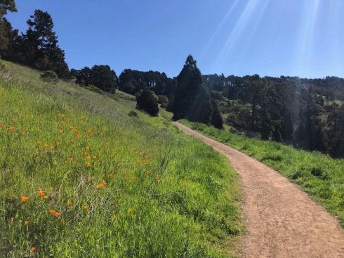
Best Season: Winter/spring when it’s cool, sunny and clear, but not muddy
EBMUD Permit Required:  Yes
Highlights:  Leave the crowds behind with a “butt kicker” that has great views of Mt. Diablo over downtown Orinda, and access to the very isolated Siesta Valley and the Grizzly Peak/Tilden Park area.
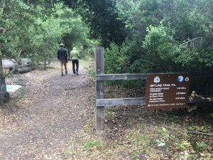
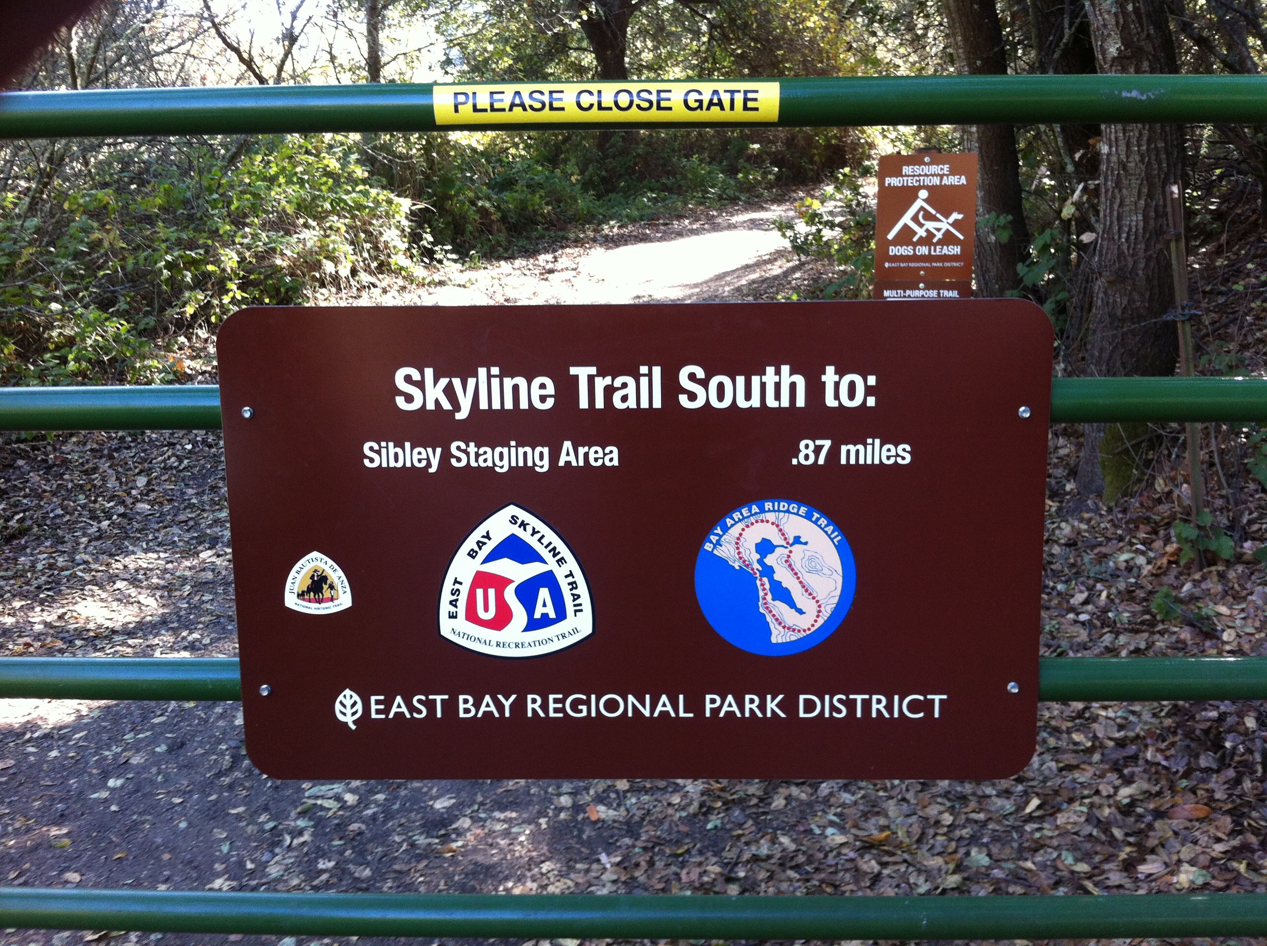
Directions:  Take Highway 24 to Orinda and exit onto Camino Pablo, going North. Take a U-turn at the first light and head back towards the highway. You’ll see a gravel parking area on the right side before reaching the highway.
Trailhead:  After parking, you’ll see the gate and kiosk at the beginning of the De Laveaga Trail.

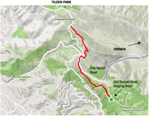
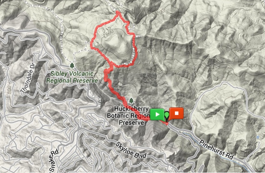
The De Laveaga Trail climbs roughly three miles from near downtown Orinda (elevation 460ft) to the Bay Area Ridge Trail & East Bay Skyline Trail adjacent to Grizzly Peak Blvd (elevation almost 1600ft). 

Map of De Laveaga Trail to Siesta Valley and Grizzly Peak Blvd.

The trail is named after the deLaveaga train station, the eastern end of the old California & Nevada Railroad that ran from 1891 until 1904 between Emeryville and Orinda, hauling farm produce and passengers.  On Sundays, trainloads of folks took the train to Orinda to picnic! The station was named after the deLaveaga family & property where the station was located.  Today, the refurbished station is located near the onramp to Highway 24 and a fun place to check out.

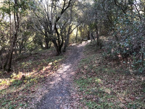
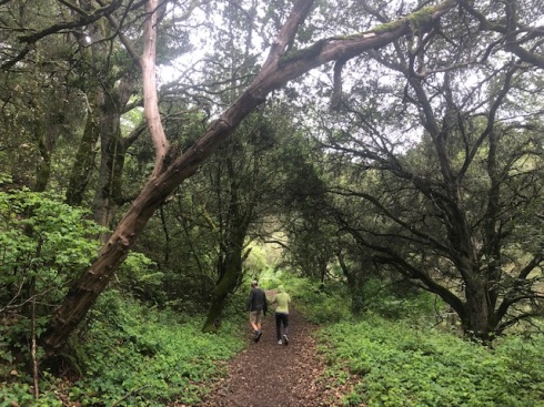
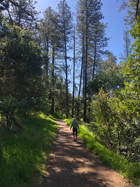
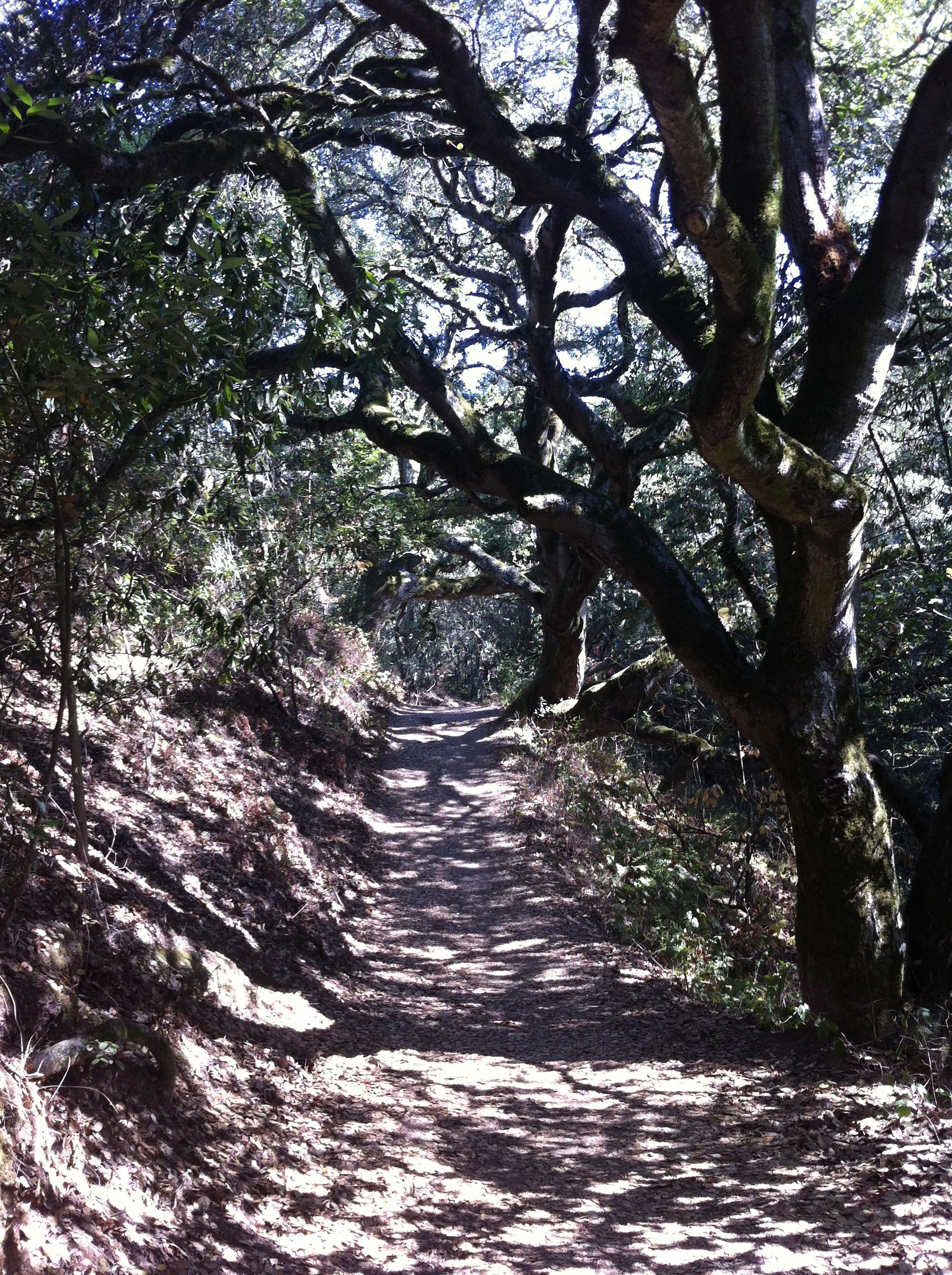
Beginning of De Laveaga Trail

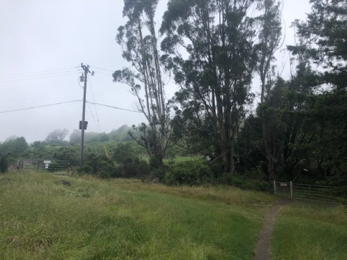
The trail starts out as a pleasant single track through a wooded area for maybe half a mile, but soon leaves the trees behind as it connects with a fire road that winds its way up the hill.

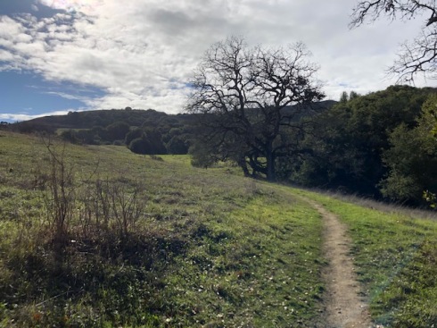
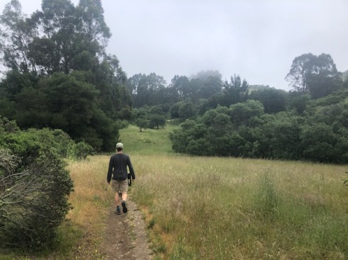
Trail opens to meadow and then fire road

Just follow the signs to stay on the trail, and the views get better and better as you climb higher and higher! If you don’t complain about all the climbing at least once, then you’re in better shape than me!  You may encounter cows, but I haven’t yet, and during one section you’ll hike under high voltage power lines.  Not where you want to stop and have a picnic.

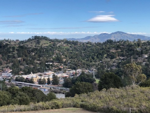
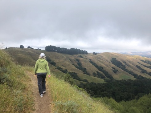
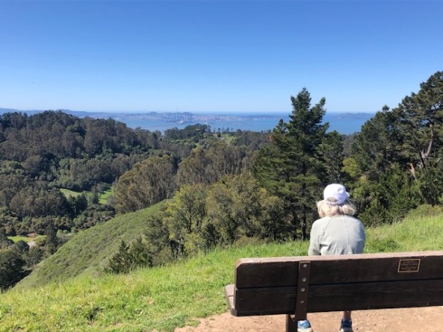
View over downtown Orinda

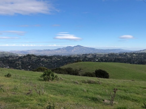
View, higher up the trail, of Mt. Diablo

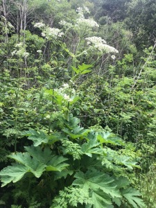
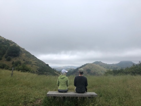
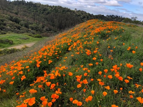
After some good climbing, and about 1.8 miles, you’ll reach a gate and a sort of pass into the Siesta Valley Recreation Area.  Just past the gate, there is a little trail to the left that goes out to Hump Peak at 1540ft – an excellent view point. Continue into the Siesta Valley. This is the most scenic part of the hike and you might feel like you have a whole hidden valley to yourself! 
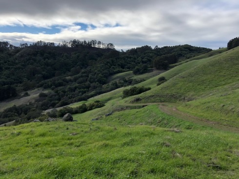
Siesta Valley

Located just down the hill is the California Shakespeare Theater (CalShakes).  Seeing a Shakespeare play or other performance there in the summer makes for a wonderful evening.  Just dress warmly!

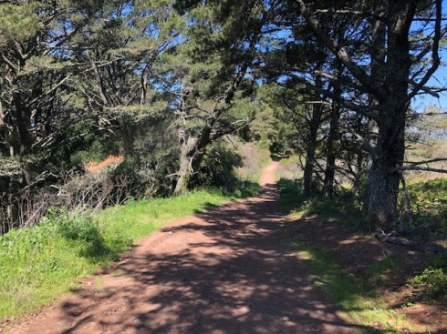
The trail drops down a ways before making a final climb up to the Skyline Trail, near Tilden Park.  There are scattered groves of eucalyptus trees (that have been thinned) and it is increasingly lush as you approach the summit.

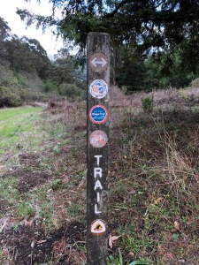
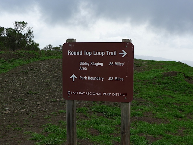
Post for Bay Area Ridge & Skyline Trail

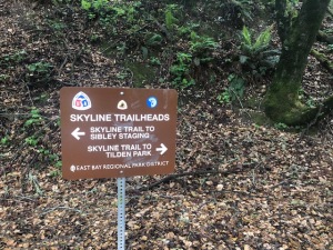
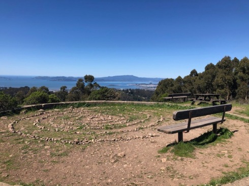
Once you reach the Skyline Trail, I like to take a left until I reach a gate adjacent to Grizzly Peak Blvd.   This is actually called the Scotts Peak Trailhead (or Skyline Gardens Trailhead?) and you can continue on a trail across the street if you want to reach an awesome view point looking out over the Bay.  But normally, I just turn around and head back the way I came.

If you take a right at the Skyline Trail, instead of going left, the trail will take you to Tilden Park.

You can also access Siesta Valley by parking at the Scotts Peak Trailhead and hiking down towards Orinda.

One time my wife and I left our home in Lafayette on foot (Burton Valley), took BART to Orinda, and then hiked the De Laveaga, with backpacks, over the hill all the way to the Claremont Hotel! I love cooking up these types of “urban adventures”! At the hotel, they started telling us about parking our car, but we didn’t have one.

Skyline to Tilden

15 May

Length: 4.3 miles. It’s an out and back so you can decide when to turn around.
Time: 1.5-2 hours
Difficulty: Easy to Medium
Dogs: Yes!
Calories: 600-700
Elevation Gain: 700 feet (starts at 1000 feet and climbs to 1600 feet).
Best Season: Any season.  Good summer hike.
EMBUD Permit Required:  No
Highlights:  The first mile is very lush with a wide range of plants and then great views towards Mount Diablo as you climb towards Tilden Park.  Downside is road noise.
Directions:  Take Highway 24 towards Oakland. Exit at Fish Ranch Road (last exit before tunnel).  Take a left at Fish Ranch Road, cross over the highway, and then take a right on Old Tunnel Road.  After about a third of a mile you’ll reach the Old Tunnel Road Staging Area for Sibley Park.  This is where you park.
Trailhead:  Old Tunnel Road will take a sharp turn, and after the turn you’ll see a trail on the right side of the road heading North.  You’ll also see signs pointing to “Skyline to Tilden” which is what you want.

NOTE: Old Tunnel Road has been closed during the stay-at-home orders, so you need to park and walk up Old Tunnel Road to reach the trail, about a third of a mile.

Most people who go to the Old Tunnel Road Staging Area are using it to access Sibley Volcanic Preserve, but for this hike we’re going to head north instead towards Tilden Park. Look for the signs for “Skyline Trail to Tilden Park”.

The Skyline Trail is a 31-mile continuous path that traverses through six of the East Bay’s most historic and picturesque parks and preserves.  It is one of 1200 designated National Recreation Trails in the U.S.  And it is part of the Bay Area Ridge Trail, a planned 550-mile trail along ridgelines ringing the Bay Area.

The first mile of the trail is surprisingly lush.  This is because the Oakland hills capture extra rain and fog and the east side of the hills have less sun and evaporation than the west side.  You’ll be able to hear Highway 24, but try to imagine you’re hearing a waterfall in the distance.

Lush zone during the first mile of trail

During the first half mile or so you’ll notice many Big Leaf Maple trees, which is quite unusual, because they are normally constrained to riparian zones along creeks.  Along with the maples, this unique zone harbors a multitude of herbaceous flowering plants such as wild strawberry, cinquefoil, forget-me-not, cow parsnip, and others.

Cow parsnip next to the trail

After a mile of hiking you’ll reach Fish Ranch Road. After crossing the road and resuming on the other side, you’ll find that you’re now in a dry grassy scrubland.  It’s worth noticing a single Juniper Tree on the right side soon after crossing.

Beginning of grassy scrubland

A short way further you’ll reach a junction and should stay to the right.  And then soon after that you’ll arrive at the bench shown below with a fantastic view out towards Mt. Diablo.

What a view!

The trail continues up the hillside, next to Grizzly Peak Blvd., with a few switchbacks.  On our hike we noticed a couple people working in a gulley between the trail and water tank with scattered coyote brush. We stopped to talk with them and found out they were part of the CA Native Plant Society and volunteering every week to remove invasive thistle and grasses, to allow native plants to return.  They meet every Sunday morning.

The trail continues on the east side of the hill, separated from the road, and this is my favorite section of the hike.  It’s quiet and very scenic with fantastic views looking out over the Siesta Valley.

View out towards Siesta Valley

After a little over 2 miles you’ll reach an EBMUD gate and see the road up to the left. This is close to Scott’s Peak Trailhead (opposite side of road) and where I usually turn around and return the same way I came.

Grizzly Peak Blvd. and EBUD gate where I normally turn around

You’ll see a fire road heading straight down the hill, which ends at Cal Shakes – a great place to see Shakespeare and other plays during the summer.

If you continue further you’ll soon reach the junction with the De La Veaga Trail, which is an EBMUD trail that winds down to Orinda (permit required).  And if you continue straight you’ll reach the Tilden Steam Train and Seaview Trailhead.

Another option is to cross the street and hike down to the Claremont Canyon Lookout.


Tilden Park Quarry-Seaview Loop

5 Apr

Length: 3.8 miles
Time: 90 minutes
Difficulty: Medium
Dogs: Yes!
Calories: 600
Elevation Gain: 812 feet
Best Season: Winter and spring when the hills are green.  Pick a clear, sunny day when it’s 55-70 degrees.  Not much shade. Trail is a little rocky and won’t get too muddy.
EMBUD Permit Required:  No
Highlights:  The views from the Seaview Trail are some of the best in the Bay Area!
Directions:  Take San Pablo Dam Road northwest from Orinda.  Take a left on Wildcat Canyon Road.  Continue roughly three miles, past Inspiration Point, until you reach the Quarry Picnic Site (on the left).
Trailhead:  Look for the signs for the Quarry Trail.

With the stay-at-home orders in Contra Costa County I’ve had quite a bit more time to hike and write up hikes.  This is an ideal hike in the spring and has wide trails which allow social distancing.  But because of the wide trails you may also encounter a few mountain bikers.

Tilden Regional Park has been called the jewel of the Easy Bay Regional Park system and is one of the three oldest parks in the system.  The 2,079 acre park was purchased all the way back in 1936. In earlier days the land was occupied by Ohlone Indians, who were driven off the land as ranchers moved in.  Eucalyptus plantations within the park were planted around 1910 by the Eucalyptus, Mahogany, & Land Company.

To begin the hike, cross through the picnic area, and look for signs for Quarry Trail.  Stay to the right and you’ll begin a gradual climb through an open meadow.

Beginning of the Quarry Trail

After about 4/10th of a mile you’ll reach a four-way intersection with the Lower Big Springs Trail.  Stay right.  You could also take Lower Big Springs Trail in the same direction, but I haven’t gone that way yet.

As you cross the meadow you’ll notice blooming California poppies and lupine in the spring and plenty of coyote brush.  There are actually a huge list of wildflowers that can be found at Tilden. For a complete Tilden Wildflower Guide (21 pages) click here.

The trail also has patches of woodland, mostly Monterey pines.

One of the little patches of woodland on the Quarry Trail

After about 1.2 miles of hiking you’ll reach the Big Springs parking area on South Park Road.  Look for the Lower Big Springs Trail heading up the hill in the same direction.  In the winter months (Nov-March), you won’t see any cars on South Park Drive because it’s closed to protect the migration process for Newts. Otherwise they are in great danger of getting run over.

You’ll climb about 2/3rds of a mile up Lower Big Springs Trail, until the trail curves sharply to the left and connects to the Seaview Trail.  Just stay left and you’ll make sure to end up heading North.

For a little over a mile you’ll be on the amazing Seaview Trail, which is also the 380 mile Bay Area Ridge Trail and the East Bay Skyline National Recreation Trail. Enjoy some of the best views in the Bay Area looking out towards San Francisco and the Golden Gate to the West, and San Pablo & Briones Reservoirs to the East, with Mt. Diablo in the background.

First view spot and bench on the Seaview Trail, with San Francisco in the distance.

As you traverse along the Seaview Trail you’ll come across a few view spots with benches and even a picnic table and small labyrinth. What a spot for a picnic lunch or watching the sunset!  The highpoint on the trail is about 1630 feet.

View area with labyrinth and picnic table, with Mt. Tamalpais in the distance.

The Seaview Trail runs atop the San Pablo Ridge, a small mountain range that runs from Pinole to Orinda.

Seaview Trail – heading north

After a bit you’ll start descending.  You’ll pass an intersection with the Lower Big Springs Trail (left side).  Continue straight and then at the next intersection make sure to stay left to take a connector trail back down to the Quarry Picnic Site.

Map of the Quarry-Seaview Loop


Tilden Park map..


Eastport to Sibley Loop

7 Mar

Length: 3.5 miles
Time:  1 hour, 30 minutes
Difficulty: Medium
Elevation Gain:  636 feet
Dogs:  Allowed
EBMUD Permit:  Not Required
Calories: Around 800
Highlights:  This was my first favorite hike in the Lamorinda area and my kids used to call it the Ladybug hike since they found a bazillion ladybugs!  Start in Canyon at the former site of “Eastport” and hike up a scenic, wooded canyon to Sibley Volcanic Preserve (reaching 1600 feet), hike around Round Top, and descend back the way you came.    This is a great year-round hike – a manageable amount of mud in the winter and a good dose of shade in the summer.
Directions:  Drive to Moraga and then go south on Canyon Road, which ends at Pinehurst Road.  Go right on Pinehurst Road.   You will pass through the tiny town of Canyon.   It’s fun to remember that a train used to run through this canyon.  After a little over two miles you will reach a hairpin turn with a fire road gate.  Park there.
Trailhead:   You will see a fire road gate and a sign that says “Lower Pinehurst Trail.”
Special Notes:  Sibley allows dogs off leash away from the parking lot, so you’ll likely run into hikers with dogs on the Round Top loop.

A couple hundred yards before reaching the hairpin turn, you will pass the spot (on the left side) where the Sacramento Northern Railroad used to go through a tunnel between Canyon and Sheperd’s Canyon (on the Oakland side).  The Sacramento Northern Railroad was an electric train that ran 183 miles from Oakland all the way to Chico.  The first stop on the East side of the tunnel was called Eastport (the eastern portal).  Eastport still shows up in Wikipedia and on Google Maps!

Eastport-gateEastport-sign

After parking at the hairpin turn, begin your hike by walking past the gate.  After about a quarter mile, and a short climb, you will reach the Skyline National Recreation Trail, which runs for 32 miles through the East Bay Hills and is part of the Bay Area Ridge Trail.  Going left will take you to Huckleberry Preserve.  Going right will take you towards Sibley Volcanic Preserve.  Go right.

Right away you will cross the San Leandro Creek, which begins near Sibley and continues for an amazing 21.7 miles through San Leandro Reservoir, Lake Chabot and then out to the Bay near the Oakland Airport.    This is one of the few places in the Lamorinda area where you can hike next to a running creek.

Eastport-climb

Climbing up the ridge to Sibley.

After following the creek for a little ways, the trail will begin climbing up a ridge, and eventually reach a little, open grassy area with pine trees behind it (see picture).  This is a great spot to catch your breath, turn around, and enjoy an amazing view.  Continue through the grove of Monterey pine trees.

Eastport-viewEastport-pine-steve

After about 25 minutes of hiking and just a hair over one mile you will reach a junction with the Round Top Loop Trail.  This trail circles around Round Top, the central feature of Sibley Volcanic Regional Preserve, and one of the highest peaks in the area at 1763 feet.  Take a right.   You will be following the Round Top Loop Trail for about a mile all the way around Round Top.

Junction with Round Top Loop Trail - take a right

Junction with Round Top Loop Trail – take a right

It’s pretty cool that we have a 10 million year old volcano in our back yard!  It features a complex volcanic center that was the source of most of the lavas that underlie the ridges from Inspiration Point in Tilden Regional Park to Moraga.  Tectonic forces on the Hayward and Moraga earthquake faults have uplifted the Berkeley hills and tilted the Round Top volcano complex on its side.  So, under the grassy cover, its guts are exposed, and a self-guided brochure is available highlighting visible geological features.

Eastport-Eucalyptus

Eucalyptus trees

In the next section of the hike there are many, many eucalyptus trees.  They have become such a familiar sight in California that many people probably don’t realize that they are really transplants from Australia. Almost all of the 600-plus species of Eucalyptus are native to Australia, where they are the dominant plants in a number of different habitats.  They are some of the tallest trees in the world and extremely drought tolerant.

After going through a cow gate, you will a junction, with a fire road heading off to the right.   For this hike you want to stay left.  Taking a right will lead you into a “land banked” area that is not open to the public yet.   Read more about this at the end of the article.

As you come down the hill you will see an overlook, where you can view the old quarry pit.   Looking down into the pit you’ll see a large labyrinth.  It was crafted in 1989 by Montclair sculptor and psychic Helena Mazzariello as “a gift to the world.”

Quarry pit with labyrinth

Quarry pit with labyrinth

Continue past the viewpoint and then take a left to stay on the Round Top Loop Trail.   After going through another cow gate, you’ll reach a junction, where you’ll see a small sign on your left that says “Geologic Marker #1.”    Hang a left at that point.  The Round Top Loop Trail continues across the paved road leading up the hill.

In a quarter mile or so you’ll cross over a road and reach the junction where you started on the Round Top Loop Trail.  Continue straight and descend back down the canyon the way you came.

View of San Leandro Creek on way back

View of San Leandro Creek on way back

Map of trail

Map of trail

Alternate Loop for the Adventurous

There is an alternate loop for those that are willing to climb fences and explore areas not open to the public.   Enter at your own risk!!  After going through the Eucalyptus zone and the cow gate, take a right at the next fire road where it says “Park Boundary 0.3 Miles.”

Eastport-Landbank-JunctionEastport-Ridge

Shortly you will reach a fire road gate that borders the land-banked area.   This land-banked area will eventually be developed and added to the Sibley Preserve.   If you continue on this fire road it will take you down a ridge with incredible views out towards Moraga and Mt. Diablo.  Stay right and you’ll eventually reach a junction with two large power line towers.  Take a right.    You’re now on the main road that led out of Eastport, off of Pinehurst Road.   As you near Pinehurst Road you’ll see old foundations and other remnants from the days when Eastport was an important train stop and small unincorporated town.   When you reach Pinehurst Road, take a right and walk along the side of the road back to your car.   You’ll walk right by the spot where the tunnel was!   Check out pictures of Eastport back in the 50’s.

Alternate Loop

Alternate Loop

Skyline to Sibley Trail

21 Oct

Length: 3.5 miles
Time:  1 hour and 20 minutes
Difficulty: Moderate.
Elevation Gain:  About 350 feet of gain from trailhead to Sibley Staging Area.
Dogs:  Yes!  Dogs are supposed to be leashed on the Skyline Trail until reaching the Sibley Staging Area and then can be off leash in Sibley, away from the parking lot.  You will typically see many happy dogs in the park!
EBMUD Permit:  Not Required
Calories: 600-700 calories
Highlights:  This is the fastest way to reach the 32-mile East Bay National Skyline Trail from Lamorinda, and an interesting and scenic way to access Sibley Volcanic Preserve.
Directions:  Take Highway 24 west towards Oakland.  Before going through the tunnel, exit on Fish Ranch Road.  At the stop sign, take a left across the highway and then take a right on Old Tunnel Road.  After about a quarter of a mile you’ll see a parking area.
Trailhead:  The new parking lot is at the bottom of Old Quarry Road, but you want to get on the Skyline Trail going south towards Sibley (look for sign shown below).  You can take it in the other direction to reach Tilden Regional Park.

The old Broadway Tunnel was 200 feet above the current Caldecott Tunnel

The old Broadway Tunnel was 200 feet above the current Caldecott Tunnel

When you first take a right on Old Tunnel Road, it’s fun to remember that this small road used to lead to the old tunnel that was 220 feet above the current Caldecott Tunnel.  It was called The Broadway Tunnel, Kennedy Tunnel, and Inter-County Tunnel.  After surviving protests from Lafayette residents that thought it would increase competition for land, the old tunnel opened in 1904.  It was 1.040 feet long, 17 feet wide and lined with timber.   Long, dark and narrow, the tunnel could only accommodate one-way traffic..   Wagon drivers lit up newspapers when entering as a signal to those at the other end to wait.  In 1915 the ceiling was raised three feet to accommodate cars and trucks.   In 1937, when the old tunnel was retired, it was handling 30,000 cars per week.  Today the Caldecott handles 160,000 cars daily!

After you park you’ll see the signs for the Skyline Trail.  The 32-mile East Bay Skyline National Recreation Trail goes through six different parks and preserves.  The trail begins at the entrance to Wildcat Canyon Regional Park in Richmond and leads through Tilden Regional Park, Sibley Volcanic Regional Preserve, Huckleberry Botanic Regional Preserve, Redwood Regional Park and Anthony Chabot Regional Park.   It is part of the larger 550 mile Bay Area Ridge Trail that circles the entire Bay Area.

To start the hike, go through the gate (shown in picture) with signs pointing the way to Sibley Volcanic Preserve.   Right away you will see a sign explaining how the Caldecott Wildlife Corridor provides an important path for animals to move between parklands on the south and north sides of Highway 24.  They certainly don’t stand much chance trying to sprint across the highway!

Skyline Gate

The wooded trail leading to Sibley

The wooded trail leading to Sibley

You will begin a steady, gradual climb through the wooded canyon adjacent to Round Top Creek, which is dry in the summer.   Many of the trees are California Bay Laurel Trees.  After about 9/10ths of a mile you will reach the parking lot and visitor center for the Sibley Volcanic Preserve.  The park is named in honor of Robert Sibley, who helped found the East Bay Regional Park District and served for 10 years on its board of directors.

Sibley Volcanic Preserve Visitor Center - 9/10th of a mile from trailhead

Sibley Volcanic Preserve Visitor Center – 9/10th of a mile from trailhead

This is a good chance to use the bathrooms, get a drink, and check out the unstaffed outdoor visitor center that has interesting displays illustrating the preserve’s geology.

It’s pretty cool that we have a 10 million year old volcano in our back yard!  It features a complex volcanic center that was the source of most of the lavas that underlie the ridges from Inspiration Point in Tilden Regional Park to Moraga.  Since the volcano’s active days, tectonic forces on the Hayward and Moraga earthquake faults have uplifted the Berkeley hills and tilted the Round Top volcano complex on its side.  So, under the grassy cover, its guts are exposed, and a self-guided brochure is available highlighting visible geological features.

Backtrack to where the Skyline Trail continues into the trees, on the north side of the visitor center.   After about a quarter mile you’ll reach an intersection of trails.  Look across to the other side of the road and you’ll see a post showing where the Skyline Trail continues.   After another fifth of a mile, you’ll intersect the road that leads up to Round Top, one of the highest peaks in the area at 1763 feet.    Cross the road and then take the Round Top Trail to the left.  The Skyline Trail continues to Huckleberry Preserve and then Redwood Regional Park.

The Round Top Trail circles around the peak for about a mile.  When you reach a viewpoint of an old quarry pit, you are about half way around.    This pit was made by quarry operations that removed huge amounts of massive basalt lava, and it now exposes the interior of the Round Top volcano.  Looking down into the pit you’ll see a large labyrinth.  It was crafted in 1989 by Montclair sculptor and psychic Helena Mazzariello as “a gift to the world.”

Continue past the viewpoint and then take a left to stay on the Round Top Trail (or see alternate loop below).   After going through a gate, you’ll reach the junction again.  Take the Scenic Overlook Trail on the right.   This will take you back to the visitor area, where you can rejoin the Skyline Trail and follow it back down to where you parked.

Skyline-to-Sibley-Map-Marked

An alternate loop that features more of the volcanic features of the park, is instead of going left to stay on the Round Top Loop Trail (after the quarry pit), is to continue on the Quarry Trail, then take a right on the Volcanic Trail which will dead end into the top of Quarry Road, which you can take back down to the staging area.  Besides the volcanic features, this way is through open hillsides and features wildflowers, like CA poppies and lupine, in the spring (see picture below). The distance or time needed for the hike doesn’t change.  The map below shows the alternate loop.

Alternate loop that features more of the volcanic features of the park


California poppies on the Volcanic Trail in the spring

Full Map of Sibley Volcanic Preserve – Trailhead for this hike is where it says “Old Tunnel Road Staging Area”