Tag Archives: bay trees

Carr Ranch Loop Trail

16 Jan

Length: 8.3 miles from parking lot
Time: 3.5-4 hours
Difficulty: Strenuous (see elevation map at bottom)
Dogs: Yes, on a leash
Calories:
1300
Elevation Gain: 2074 feet, lots of climbing
Best Season: Winter or Spring after a couple weeks without rain – to avoid mud
EMBUD Permit Required: Yes
To Bring Along: Plenty of water and a snack
Highlights:  Explore the newest open space around Lamorinda – Carr Ranch! 604 acres just opened on October 14th, 2017. Perfect if you’re looking to get away from it all and want a real workout.
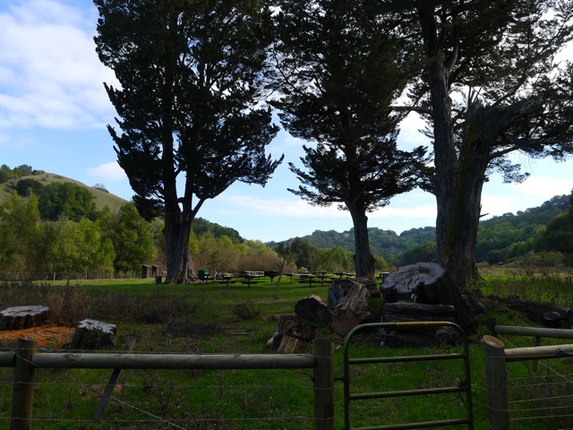
Directions: Take Canyon Road south from Moraga. Take a left on Camino Pablo and take it all the way until you reach Rancho Laguna Park. Park in the parking lot just past Knoll Drive.
Trailhead: The EMBUD trailhead and sign-in is at the back of the park.

Carr Ranch was owned for over 100 years by the Carr Family. Muir Land Trust was able to purchase it in November 2016 with the help of $7 million in donations received from individuals, foundations, agencies, and businesses. The 604 acres of unspoiled ranch and wild lands is now permanently protected and open for us all to enjoy! The only prior inhabitants of Carr Ranch have been wildlife and cows grazing.

To start the hike, walk to the back of Rancho Laguna Park and you’ll see an EBMUD sign-in kiosk and gate. To access the Carr Ranch Loop Trail you need to take the EBMUD Rocky Ridge Trail for about 2 miles.  Official Carr Ranch Trail Map…

Beginning of Rocky Ridge Trail

After climbing a little hill you’ll take a right on the Rancho Laguna Trail and go about .4 miles to reach a sign for the Rocky Ridge Trail (heading East).

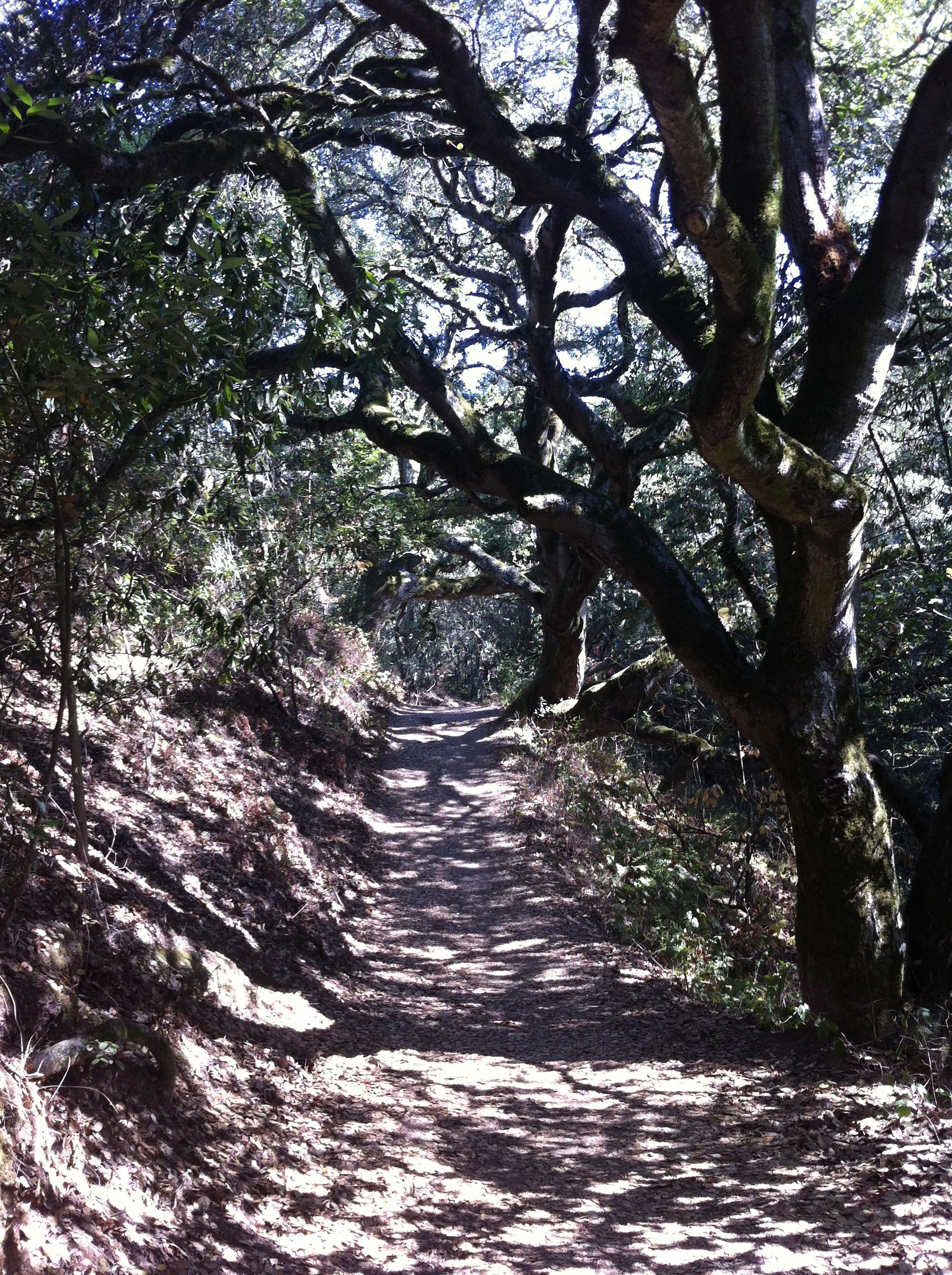
The trail runs adjacent to a creek and then ascends through a forest of coast live oak and bay laurel trees. You may notice many logs on the ground with bracket fungi growing on them (see picture).  Over 1000 varieties have been discovered!  These and other decomposer fungi are the first step in food chains that feed on decomposed plant material. Anyway, then you’ll emerge onto a high meadow and continue climbing to the top of the first hill at 1097 feet.

Hiking up through oak and bay laurel woodlands

Bracket fungi on fallen trees

After descending down the other side, and hiking about 2 miles or so, you’ll reach the year-round Buckhorn Creek, an untouched riparian habitat. It drains into the Upper San Leandro Reservoir and so all of this land is part of the huge watershed for the Reservoir. And as you cross the creek, imagine for a moment that you’re far under water. It could have been. At one point in the late 80’s EBMUD proposed to build a new reservoir in the Buckhorn Creek Valley, but fortunately it was opposed and finally shelved.

Standing next to Buckhorn Creek

After another tenth of a mile, you’ll reach the turn off to the Carr Ranch Loop Trail (see picture). Take a left, instead of zig-zagging up the hill, and soon you’ll reach the 3.5 mile loop. We went to the right, hiking the loop counter-clockwise.

Turn off to Carr Ranch Loop Trail – about two miles from the start and a tenth of a mile past Buckhorn Creek

During the first part of the loop you’ll hike through the trees, adjacent to Buckhorn Creek. We noticed many, many acorns on the ground, which were a staple for the Native Americans that lived in this area.

Beginning of the Carr Ranch Loop Trail

Tons of acorns!

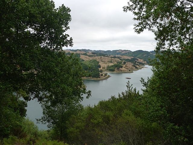
Soon you’ll begin climbing and climbing, up, up, up to the ridge that surrounds the valley. At about 4.5 miles of hiking you’ll reach the high point of 1275 feet. There is a fire road heading off to the right that actually leads to the back of St. Mary’s College. But the Loop Trail continues straight. Enjoy the vistas of undeveloped land in all directions!

View of Carr Ranch – about half way through the hike

Approaching the summit of 1275 feet

After another mile and a half you’ll reach the junction where you started on the loop. Return the same way that you came.

During your hike you may notice a shrub that looks like this (picture) and somehow thrives on these dry hillsides. It’s called Coyote Brush. Like all native plants it has evolved to survive without water from May through October. We have shifted most of our yard to native plants and have a couple large Coyote Brush plants that seeded themselves and didn’t cost us a penny!

Coyote Brush

One other thing you might notice is that there is almost no noise of any kind on Carr Ranch, except for planes flying overhead. Unfortunately there is a bit of a highway overhead with planes heading East from SFO and Oakland. This is becoming a bigger and bigger issue. Save Our Skies is fighting to protect our skies in the East Bay.  Their motto is “Too many, too loud, too often”.

You may encounter cows on this trail. No worries. Just walk in a wide arc around them and make sure not to get between a mother and a new calf. EBMUD and the East Bay Regional Park District both lease some grassland areas for cattle grazing. This is to keep the grass height down, which lessens the fire hazard during the dry season.

Muir Land Trust has now protected over 3,000 acres in the East Bay, all dedicated to open space forever! Learn more at www.jmlt.org.

Skyline to Sibley Trail

21 Oct

Length: 3.5 miles
Time:  1 hour and 20 minutes
Difficulty: Moderate.
Elevation Gain:  About 350 feet of gain from trailhead to Sibley Staging Area.
Dogs:  Yes!  Dogs are supposed to be leashed on the Skyline Trail until reaching the Sibley Staging Area and then can be off leash in Sibley, away from the parking lot.  You will typically see many happy dogs in the park!
EBMUD Permit:  Not Required
Calories: 600-700 calories
Highlights:  This is the fastest way to reach the 32-mile East Bay National Skyline Trail from Lamorinda, and an interesting and scenic way to access Sibley Volcanic Preserve.
Directions:  Take Highway 24 west towards Oakland.  Before going through the tunnel, exit on Fish Ranch Road.  At the stop sign, take a left across the highway and then take a right on Old Tunnel Road.  After about a quarter of a mile you’ll see a parking area.
Trailhead:  The new parking lot is at the bottom of Old Quarry Road, but you want to get on the Skyline Trail going south towards Sibley (look for sign shown below).  You can take it in the other direction to reach Tilden Regional Park.

The old Broadway Tunnel was 200 feet above the current Caldecott Tunnel

The old Broadway Tunnel was 200 feet above the current Caldecott Tunnel

When you first take a right on Old Tunnel Road, it’s fun to remember that this small road used to lead to the old tunnel that was 220 feet above the current Caldecott Tunnel.  It was called The Broadway Tunnel, Kennedy Tunnel, and Inter-County Tunnel.  After surviving protests from Lafayette residents that thought it would increase competition for land, the old tunnel opened in 1904.  It was 1.040 feet long, 17 feet wide and lined with timber.   Long, dark and narrow, the tunnel could only accommodate one-way traffic..   Wagon drivers lit up newspapers when entering as a signal to those at the other end to wait.  In 1915 the ceiling was raised three feet to accommodate cars and trucks.   In 1937, when the old tunnel was retired, it was handling 30,000 cars per week.  Today the Caldecott handles 160,000 cars daily!

After you park you’ll see the signs for the Skyline Trail.  The 32-mile East Bay Skyline National Recreation Trail goes through six different parks and preserves.  The trail begins at the entrance to Wildcat Canyon Regional Park in Richmond and leads through Tilden Regional Park, Sibley Volcanic Regional Preserve, Huckleberry Botanic Regional Preserve, Redwood Regional Park and Anthony Chabot Regional Park.   It is part of the larger 550 mile Bay Area Ridge Trail that circles the entire Bay Area.

To start the hike, go through the gate (shown in picture) with signs pointing the way to Sibley Volcanic Preserve.   Right away you will see a sign explaining how the Caldecott Wildlife Corridor provides an important path for animals to move between parklands on the south and north sides of Highway 24.  They certainly don’t stand much chance trying to sprint across the highway!

Skyline Gate

The wooded trail leading to Sibley

The wooded trail leading to Sibley

You will begin a steady, gradual climb through the wooded canyon adjacent to Round Top Creek, which is dry in the summer.   Many of the trees are California Bay Laurel Trees.  After about 9/10ths of a mile you will reach the parking lot and visitor center for the Sibley Volcanic Preserve.  The park is named in honor of Robert Sibley, who helped found the East Bay Regional Park District and served for 10 years on its board of directors.

Sibley Volcanic Preserve Visitor Center - 9/10th of a mile from trailhead

Sibley Volcanic Preserve Visitor Center – 9/10th of a mile from trailhead

This is a good chance to use the bathrooms, get a drink, and check out the unstaffed outdoor visitor center that has interesting displays illustrating the preserve’s geology.

It’s pretty cool that we have a 10 million year old volcano in our back yard!  It features a complex volcanic center that was the source of most of the lavas that underlie the ridges from Inspiration Point in Tilden Regional Park to Moraga.  Since the volcano’s active days, tectonic forces on the Hayward and Moraga earthquake faults have uplifted the Berkeley hills and tilted the Round Top volcano complex on its side.  So, under the grassy cover, its guts are exposed, and a self-guided brochure is available highlighting visible geological features.

Backtrack to where the Skyline Trail continues into the trees, on the north side of the visitor center.   After about a quarter mile you’ll reach an intersection of trails.  Look across to the other side of the road and you’ll see a post showing where the Skyline Trail continues.   After another fifth of a mile, you’ll intersect the road that leads up to Round Top, one of the highest peaks in the area at 1763 feet.    Cross the road and then take the Round Top Trail to the left.  The Skyline Trail continues to Huckleberry Preserve and then Redwood Regional Park.

The Round Top Trail circles around the peak for about a mile.  When you reach a viewpoint of an old quarry pit, you are about half way around.    This pit was made by quarry operations that removed huge amounts of massive basalt lava, and it now exposes the interior of the Round Top volcano.  Looking down into the pit you’ll see a large labyrinth.  It was crafted in 1989 by Montclair sculptor and psychic Helena Mazzariello as “a gift to the world.”

Continue past the viewpoint and then take a left to stay on the Round Top Trail (or see alternate loop below).   After going through a gate, you’ll reach the junction again.  Take the Scenic Overlook Trail on the right.   This will take you back to the visitor area, where you can rejoin the Skyline Trail and follow it back down to where you parked.

Skyline-to-Sibley-Map-Marked

An alternate loop that features more of the volcanic features of the park, is instead of going left to stay on the Round Top Loop Trail (after the quarry pit), is to continue on the Quarry Trail, then take a right on the Volcanic Trail which will dead end into the top of Quarry Road, which you can take back down to the staging area.  Besides the volcanic features, this way is through open hillsides and features wildflowers, like CA poppies and lupine, in the spring (see picture below). The distance or time needed for the hike doesn’t change.  The map below shows the alternate loop.

Alternate loop that features more of the volcanic features of the park


California poppies on the Volcanic Trail in the spring

Full Map of Sibley Volcanic Preserve – Trailhead for this hike is where it says “Old Tunnel Road Staging Area”

Bear Creek Trail

15 Oct

Length: 4.3 miles (for entire trail)
Time:  Any amount of time up to 2 hours (depending on where you turn around)
Difficulty: Easy to Moderate.
Elevation Gain: Modest
Dogs:  Not Allowed
EBMUD Permit:  Required
Calories: 800-900 (for 90 min hike)
Highlights:  The Bear Creek Trail traverses the south side of Briones Reservoir.  It is an outstanding trail that’s forested, has beautiful water views, and minimal climbing to contend with.  You can start on the Briones Dam side or the Briones Creek side and hike as far as you’d like and turn around.
Directions to Briones Overlook Trailhead (from Orinda):  From Orinda take Camino Pablo north towards San Pablo Dam Road.  Take a right on Bear Creek Road and go a couple miles to the Briones Overlook Staging Area (on the left).  The trailhead is on the northwest corner of the parking lot.
Directions to Bear Creek Trailhead (from Lafayette):  From Lafayette take Happy Valley Road up over the hill to Bear Creek Road.  Take a right and then a quick left into the Bear Creek Staging Area.   This staging area is on the opposite side of the road from the entrance to Briones Regional Park.   The trailhead is on the creek side of the parking lot.
Special Notes:  There’s a lot of poison oak here, although the trail is well-used and generally clear.

This is really one of the best trails in the Lamorinda area.  You can start on either end and turn around whenever you feel like it.  I typically hike about 45 minutes before turning back.  There is a high point with two benches that also makes a good turnaround spot.  The other option is to use two cars and leave a car at the end you’re hiking towards.  Then you can complete the entire trail.

The trail runs between Bear Creek Road and the Briones Reservoir, along the southern slopes of the Reservoir.  The south side is much more wooded (mostly Bay Laurel) than the north side that has scattered oak trees.  Along the way there are many great views of the Briones Reservoir.

Hiking from the Bear Creek Staging Area:

Crossing Bear Creek

Crossing Bear Creek

Enter the gate on the left, cross the creek, and then you’ll arrive at an old unused paved road.  Take a right and follow the straight road/path towards the reservoir.   The open area is an old tree farm.   A dirt fire road follows the shoreline and then begins to climb and changes into a singletrack trail.

Bear-Creek-2Bear-Creek-3

After about 1.7 miles you’ll reach a service road.  Look for posts with directional arrows that show how to stay on the Bear Creek Trail.  Soon you’ll crest at a high point with two benches.  This is a great spot for a picnic/snack before turning around.

Bear-Creek4Bear-Creek-5

If you continue you’ll begin to go gradually down towards the Briones Overlook staging area – near the dam.

Two benches at high point of trail - reached after about 60 minutes of hiking

Two benches at high point of trail – reached after about 60 minutes of hiking

Hiking from the Briones Overlook Staging Area:

Briones-Dam-1Briones-Dam-2

Enter the gate on the northwest side.  You’ll begin to gradually climb and wind along the slopes of the reservoir with views out towards the dam.   Briones Dam is an earthen dam that was completed in 1964.  It is the largest of EBMUD’s five East Bay terminal reservoirs with a total capacity of 60,510 acre·ft (74,640,000 m3).

View of Briones Dam from trail

View of Briones Dam from trail

After about 30-40 minutes you’ll reach a high point with two benches that make for a good spot to have a snack and possibly turn around.   After this point you will gradually begin to descend towards Bear Creek at the far end of the reservoir.

Briones-Dam-4Briones-Dam-5

The map below shows a hike that went about 45 minutes from the staging area before turning around.

Map of Bear Creek Trail - red line shows hiking for 45 minutes from Briones Dam side of trail.

Map of Bear Creek Trail – red line shows hiking for 45 minutes from Briones Dam side of trail.

King Canyon Loop

25 May

Length: 6.6 miles
Time:  2.5 hours
Difficulty: Long hike with one steep section
Elevation Gain: 643 feet
Dogs:  Allowed
EBMUD Permit:  Required
Calories: 1200
Highlights:  If you love the Lafayette Reservoir Rim Trail then you’ll love this hike.  It’s a similar degree of difficulty, but a little longer and with fewer people.  This trail leaves from the Valley Vista Staging Area, just south of Moraga, and skirts along the northern edge of Upper San Leandro Reservoir, which feels a world away from the rat race in Moraga (kidding).
Directions:  Drive to Moraga.   Take Canyon Road until you see the Valle Vista Staging Area on your left.  Park.
Trailhead:   You will see a gate and a sign-in kiosk where you enter your EBMUD permit info.  Take the trail to the left.
Special Notes:  Make sure to bring plenty of water!

This is the only trail next to the sprawling San Leandro Reservoir, which was completed back in 1926 by the East Bay Water Co.   It receives water from the San Leandro Creek, which runs adjacent to Pinehurst Road and the small town of Canyon, traveling a total of 21.7 miles along the eastern side of the Oakland and San Leandro Hills.  The creek is famous for having been the site of the first rainbow trout hatchery in the world.   There are signs about the rainbow trout along Redwood Creek in Redwood Regional Park.

Beginning of the Kings Canyon Loop

Beginning of the King Canyon Loop

The King Canyon Loop starts at the Valley Vista Staging Area.  After you go through the gate and sign in (EBMUD permit required), head down to the left towards the reservoir on the Rocky Ridge Trail.  After about a quarter mile, take the trail that veers to the left down a little hill.  This will take you through a pleasant forest of monterey pines (picture below).   It is native to three very limited areas located in Santa Cruz, Monterey Peninsula, and San Luis Obispo Counties.  When you reach a fire road, take a right, crossing the bridge over Moraga Creek, and then passing a working ranch area with horses (picture below).  After you go through a gate, you will reach a junction.  The Rocky Ridge trail goes up the hill to the left.  Continue straight or to the right along the reservoir.   This is the beginning of the King Canyon Trail.

Knobcone pine forestKings-Canyon-Ranch

The trail winds, up and down, through a forest of California bay trees and oak trees along the northern side of the Reservoir (see picture).    There are many views of the Reservoir along the way, but you’ll reach the best view after about an hour of hiking.  There is a clearing with a bench and a perfect view of the Reservoir looking south (see picture).  It’s worth a stop for a few minutes!  This is a perfect place to have a little snack or picnic lunch.  With no signs of civilization in any direction it seems a world away.

Kings-Canyon-Trail

The King Canyon Trail

Kings-Canyon-Bench

My favorite hiking partner admiring the view of Upper San Leandro Reservoir!

When you continue, the trail will begin to turn away from the Reservoir along an inlet.  The inlet gets marshy towards the end and is a great place to spot birds.   After a little ways you will reach a gate near Rancho Laguna Park.  This is officially the end of the King Canyon Trail and for the rest of the loop you will be on the Rocky Ridge Trail.   From here it’s 2.6 miles back to the parking lot.

Take the single-track trail to the left.  When you reach a tiny creek bed, the trail appears to go right and left.  Make sure to go left up the hill.   Next, you will reach a fire road that goes straight up/down the hill.  Take a left up the hill.  This is the steepest part of the hike!  Take the second right turn.   The wrong turns will say “Fire Road Closed to Public.”  On the next stretch you will see views of Moraga in the distance and then a great view towards the Valley Vista Staging Area once you emerge from the trees.   After a steep down section, you’ll reach a junction where you take a left down the hill.  Take a right at the bottom, going back to the staging area the way you came.

View of Moraga

View of Moraga on the way back

If you don’t have time for the whole loop, you can easily hike as far as you want on the King Canyon Trail and then turn around.    For instance you can turn around at 45 minutes for a 1.5 hour hike.

Hike goes counter-clockwise

Hike goes counter-clockwise

Bear Creek Loop in Briones

21 Mar

Length: 2 miles or 5 miles (longer version)
Time:  1 Hour
Difficulty: Easy.  Fine for kids.
Elevation Gain: 371 feet
Dogs:  Allowed
EBMUD Permit:  Not required.
Calories: 450
Highlights:  When most people think of Briones Regional Park they think of rolling hills with a huge network of fire roads to hike or bike on.  But the Bear Creek Trail offers one of the few “single track” trails that winds through a more woodsy and shaded part of the park.  This is very pleasant trail that anyone can enjoy that reaches a scenic picnic area for a lunch or dinner stop.

Trailhead

Trailhead

Directions:  From Lafayette take Happy Valley Road up over the hill to Bear Creek Road.  Take a right and then another right into the Bear Creek Staging Area.  From Orinda take Camino Pablo north towards San Pablo Dam Road.  Take a right on Bear Creek Road and go five miles to the Bear Creek Staging Area.  Drive into the park – staying to the right – and park in the large gravel lot at the end of the road.
Trailhead:   After you’ve parked then backtrack to the picnic area until you see the Bear Creek Trail sign (see picture).

Briones Regional Park is a huge, uncrowded park with 6,256 acres of parkland for recreation.  The land was originally part of Rancho Boca de la Canada del Pinole (rancho at the mouth of Pinole Canyon), popularly known as Rancho San Felipe and later Rancho Briones.  In 1829 Felipe Briones built a home near the Bear Creek entrance, cultivating the land and raising cattle.   Cattle grazing has been the major land use in the Bear Creek watershed ever since.

From the picnic area, the Bear Creek trail descends down to the creek.  This is a nice spot to pause for a few minutes.  You might wonder how the creek got its name.  The name came from a 1000-pound bear shot by Ramon Briones, near Bear Creek Falls, in 1897 (see photo).  This was the largest bear killed in Contra Costa County.   Bears used to inhabit this area, especially the foothills of Mt. Diablo.

Bear-Creek1000Bear

From the creek you will ascend into a forest of mostly California Bay Laurel trees – a cousin of the Mediterranean Bay tree whose leaves are used in cooking.  Bear Creek’s banks are also lined with coast live oak, willow, madrone, and big leaf maple.   The trail winds along the side of the hill, above the creek, heading east.

Bear-Creek-Trail

Bear Creek Trail winds through a bay forest…

Bear-Creek-Newt

California Newt

In the spring you might spot a California newt near the trail.  This tiny amphibian thrives in Briones around Bear Creek.  It spends most of its time living in burrows and holes. But once year, the newts make an epic migration (at least for them) to nearby ponds for mating season.  I happened to spot one in February (see photo).

After about a mile you will reach a group camping site called Homestead Valley.  This is a great spot to hang out and have a snack or lunch, especially with kids… or maybe a picnic dinner in the summer.

Homestead Valley group camping and picnic area

Homestead Valley group camping and picnic area

When you depart this clearing you will cross a little seasonal stream and reach the Seaborg Trail.  For a two-mile loop take a left and then another left at the three-way junction to head back to the staging area.

Map of 2 mile loop

Map of 2 mile loop

For a longer 5-mile loop, take a right on the Seaborg Trail.  After a little ways you will start climbing into the hills and will reach the Briones Crest Trail.  The Briones Crest Trail is the spine of the park and offers great views of Mt. Diablo, etc.  About a half mile later you will reach the Crescent Ridge Trail.  Take a left and descend back down into the valley. You will pass an archery range, which is a lot of fun with kids if you have access to some bows and arrows.  There is a course very much like a 9 hole golf course. After passing the archery range, you will reach a three-way junction with Seaborg Trail.  Stay right and you will end up back at the staging area.

Map of 5 mile loop

Map of 5 mile loop