Tag Archives: newt

Tilden Park Quarry-Seaview Loop

5 Apr

Length: 3.8 miles
Time: 90 minutes
Difficulty: Medium
Dogs: Yes!
Calories: 600
Elevation Gain: 812 feet
Best Season: Winter and spring when the hills are green.  Pick a clear, sunny day when it’s 55-70 degrees.  Not much shade. Trail is a little rocky and won’t get too muddy.
EMBUD Permit Required:  No
Highlights:  The views from the Seaview Trail are some of the best in the Bay Area!
Directions:  Take San Pablo Dam Road northwest from Orinda.  Take a left on Wildcat Canyon Road.  Continue roughly three miles, past Inspiration Point, until you reach the Quarry Picnic Site (on the left).
Trailhead:  Look for the signs for the Quarry Trail.

With the stay-at-home orders in Contra Costa County I’ve had quite a bit more time to hike and write up hikes.  This is an ideal hike in the spring and has wide trails which allow social distancing.  But because of the wide trails you may also encounter a few mountain bikers.

Tilden Regional Park has been called the jewel of the Easy Bay Regional Park system and is one of the three oldest parks in the system.  The 2,079 acre park was purchased all the way back in 1936. In earlier days the land was occupied by Ohlone Indians, who were driven off the land as ranchers moved in.  Eucalyptus plantations within the park were planted around 1910 by the Eucalyptus, Mahogany, & Land Company.

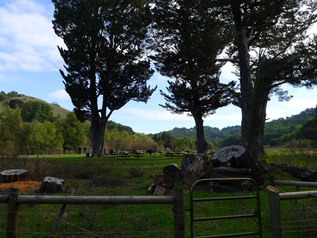
To begin the hike, cross through the picnic area, and look for signs for Quarry Trail.  Stay to the right and you’ll begin a gradual climb through an open meadow.

Beginning of the Quarry Trail

After about 4/10th of a mile you’ll reach a four-way intersection with the Lower Big Springs Trail.  Stay right.  You could also take Lower Big Springs Trail in the same direction, but I haven’t gone that way yet.

As you cross the meadow you’ll notice blooming California poppies and lupine in the spring and plenty of coyote brush.  There are actually a huge list of wildflowers that can be found at Tilden. For a complete Tilden Wildflower Guide (21 pages) click here.

The trail also has patches of woodland, mostly Monterey pines.

One of the little patches of woodland on the Quarry Trail

After about 1.2 miles of hiking you’ll reach the Big Springs parking area on South Park Road.  Look for the Lower Big Springs Trail heading up the hill in the same direction.  In the winter months (Nov-March), you won’t see any cars on South Park Drive because it’s closed to protect the migration process for Newts. Otherwise they are in great danger of getting run over.

You’ll climb about 2/3rds of a mile up Lower Big Springs Trail, until the trail curves sharply to the left and connects to the Seaview Trail.  Just stay left and you’ll make sure to end up heading North.

For a little over a mile you’ll be on the amazing Seaview Trail, which is also the 380 mile Bay Area Ridge Trail and the East Bay Skyline National Recreation Trail. Enjoy some of the best views in the Bay Area looking out towards San Francisco and the Golden Gate to the West, and San Pablo & Briones Reservoirs to the East, with Mt. Diablo in the background.

First view spot and bench on the Seaview Trail, with San Francisco in the distance.

As you traverse along the Seaview Trail you’ll come across a few view spots with benches and even a picnic table and small labyrinth. What a spot for a picnic lunch or watching the sunset!  The highpoint on the trail is about 1630 feet.

View area with labyrinth and picnic table, with Mt. Tamalpais in the distance.

The Seaview Trail runs atop the San Pablo Ridge, a small mountain range that runs from Pinole to Orinda.

Seaview Trail – heading north

After a bit you’ll start descending.  You’ll pass an intersection with the Lower Big Springs Trail (left side).  Continue straight and then at the next intersection make sure to stay left to take a connector trail back down to the Quarry Picnic Site.

Map of the Quarry-Seaview Loop


Tilden Park map..


Bear Creek Loop in Briones

21 Mar

Length: 2 miles or 5 miles (longer version)
Time:  1 Hour
Difficulty: Easy.  Fine for kids.
Elevation Gain: 371 feet
Dogs:  Allowed
EBMUD Permit:  Not required.
Calories: 450
Highlights:  When most people think of Briones Regional Park they think of rolling hills with a huge network of fire roads to hike or bike on.  But the Bear Creek Trail offers one of the few “single track” trails that winds through a more woodsy and shaded part of the park.  This is very pleasant trail that anyone can enjoy that reaches a scenic picnic area for a lunch or dinner stop.

Trailhead

Trailhead

Directions:  From Lafayette take Happy Valley Road up over the hill to Bear Creek Road.  Take a right and then another right into the Bear Creek Staging Area.  From Orinda take Camino Pablo north towards San Pablo Dam Road.  Take a right on Bear Creek Road and go five miles to the Bear Creek Staging Area.  Drive into the park – staying to the right – and park in the large gravel lot at the end of the road.
Trailhead:   After you’ve parked then backtrack to the picnic area until you see the Bear Creek Trail sign (see picture).

Briones Regional Park is a huge, uncrowded park with 6,256 acres of parkland for recreation.  The land was originally part of Rancho Boca de la Canada del Pinole (rancho at the mouth of Pinole Canyon), popularly known as Rancho San Felipe and later Rancho Briones.  In 1829 Felipe Briones built a home near the Bear Creek entrance, cultivating the land and raising cattle.   Cattle grazing has been the major land use in the Bear Creek watershed ever since.

From the picnic area, the Bear Creek trail descends down to the creek.  This is a nice spot to pause for a few minutes.  You might wonder how the creek got its name.  The name came from a 1000-pound bear shot by Ramon Briones, near Bear Creek Falls, in 1897 (see photo).  This was the largest bear killed in Contra Costa County.   Bears used to inhabit this area, especially the foothills of Mt. Diablo.

Bear-Creek1000Bear

From the creek you will ascend into a forest of mostly California Bay Laurel trees – a cousin of the Mediterranean Bay tree whose leaves are used in cooking.  Bear Creek’s banks are also lined with coast live oak, willow, madrone, and big leaf maple.   The trail winds along the side of the hill, above the creek, heading east.

Bear-Creek-Trail

Bear Creek Trail winds through a bay forest…

Bear-Creek-Newt

California Newt

In the spring you might spot a California newt near the trail.  This tiny amphibian thrives in Briones around Bear Creek.  It spends most of its time living in burrows and holes. But once year, the newts make an epic migration (at least for them) to nearby ponds for mating season.  I happened to spot one in February (see photo).

After about a mile you will reach a group camping site called Homestead Valley.  This is a great spot to hang out and have a snack or lunch, especially with kids… or maybe a picnic dinner in the summer.

Homestead Valley group camping and picnic area

Homestead Valley group camping and picnic area

When you depart this clearing you will cross a little seasonal stream and reach the Seaborg Trail.  For a two-mile loop take a left and then another left at the three-way junction to head back to the staging area.

Map of 2 mile loop

Map of 2 mile loop

For a longer 5-mile loop, take a right on the Seaborg Trail.  After a little ways you will start climbing into the hills and will reach the Briones Crest Trail.  The Briones Crest Trail is the spine of the park and offers great views of Mt. Diablo, etc.  About a half mile later you will reach the Crescent Ridge Trail.  Take a left and descend back down into the valley. You will pass an archery range, which is a lot of fun with kids if you have access to some bows and arrows.  There is a course very much like a 9 hole golf course. After passing the archery range, you will reach a three-way junction with Seaborg Trail.  Stay right and you will end up back at the staging area.

Map of 5 mile loop

Map of 5 mile loop