Length: 6.4 miles
Time: 2.5 hours
Difficulty: Medium
Dogs: Yes!
Calories: ~1000
Elevation Gain: ~1500 feet
Best Season: Winter and spring when the hills are green. Fall can be nice as well.
EMBUD Permit Required: No
Highlights: Blue Oak woodland and panoramic views from Briones Crest Trail & Briones Peak
Directions: From Highway 24 take Pleasant Hill Road exit and head north. Veer left on Taylor Blvd. Take a left on Withers Avenue. Right on Reliez Valley Road and then you’ll see the Reliez Valley Staging Area on your left. OR plug “Reliez Valley Staging Area” or “Reliez Valley Trail Head” into your map application.
Trailhead: At the west end of the small parking lot.
At 6,256 acres, Briones is certainly the largest regional park in the Lamorinda area with multiple points of entry and it’s fun to think that John Muir hiked these hills in the late 1800s. This staging area and trailhead is especially convenient for anyone living in the Springhill neighborhood of Lafayette, but for others it’s only about a six minute drive from Highway 24 & Pleasant Hill Road (3.5 miles).

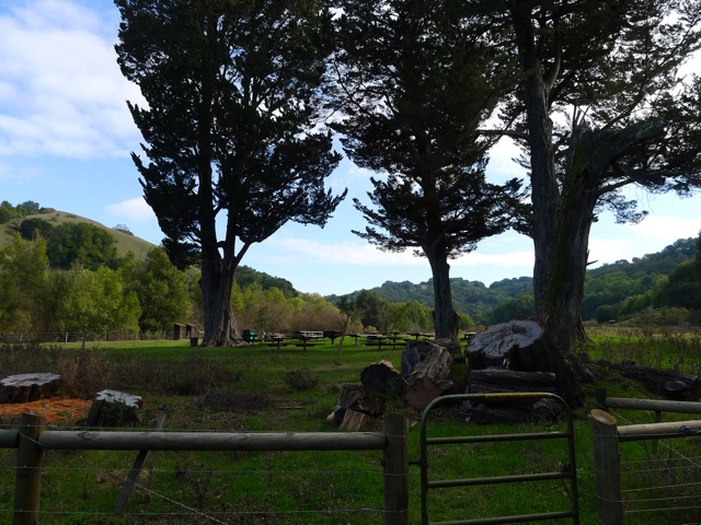
Reliez Valley Staging Area
To start the hike head through the gate to begin on the Blue Oak Trail. You’ll ascend through open grasslands with scattered oaks for about a mile until you reach a junction.

Blue Oak Trail (on left) as dusk approaches
You can reach the Spengler Trail either by taking a right on the Blue Oak, up a steep open hill, or continue straight to scramble up the Blue Oak Shortcut, which I prefer.

Blue Oak leaf
Either way, when you reach the Spengler Trail go right. You’ll be walking through a Blue Oak woodland. This is the only chance you’ll get to see Blue Oaks on this hike, which are more common the farther you go East. They are the most heat and drought tolerant of our native oaks, and the leaves develop a bluish cast as we progress into summer and fall. You can identify them by looking closely at one or more of the leaves, which are deciduous, smooth edged, and shallowly lobed (see picture).

Blue Oak woodland at intersection of Spengler and Blue Oak Trail

Ivan Dickson Memorial Trail marker
Continue following the wooded Spengler Trail. You’ll reach post/marker 49, marker 48, and then marker 46. You’ll notice on marker 46 “Ivan Dickson Memorial Loop Trail.” This is an 11.7 mile grand loop of Briones Regional Park, in honor of Ivan Dickson. The loop includes going out to Ivan Dickson Point (near Bear Creek Road) and seeing a special stone bench in his honor. A passionate hiker and lifelong member of the Berkeley Hiking Club, he left $427K in 1993 for a special gift fund to support a volunteer trail maintenance program that will allow future generations to “take good care of the trails” in perpetuity.
After thanking Ivan, continue straight (angling to the left) on the Spengler Trail. Do not take the Diablo View Trail to the right. You’ll begin to drop into a more lush canyon with the Alhambra Creek (marker 37). The creek starts in Briones and flows about six miles, through downtown Martinez, and into the Carquinez Strait.

Checking out some lupine near Alhambra Creek
Climb out of the canyon until you reach the Old Briones Road Trail (marker 24), where you’ll take a left.
This is in the vicinity of two vernal ponds, the Maricich Lagoons, which attracts some birds. We actually saw some cows chasing a great blue heron from their field, a sight we were sure we’d never see again. A long time ago, it was thought that the lagoons represented a vast underground store of water – wishful thinking for sure.
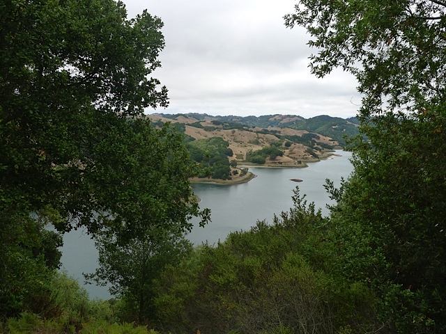
As you climb up the hill you’ll begin to see excellent views north and north-east towards the Carquinez Strait.
When you reach the Briones Crest trail, take a left. After a little over a half of a mile you’ll see a little trail going up the hill to Briones Peak. This is worth a little detour to stand at the peak (1483 feet) and enjoy panoramic views of the Delta, Mount Diablo, and even Mount Tamalpais.

View of Mt. Diablo from Briones Crest Trail
Once you continue on the Briones Crest trail, you’ll want to stay left and take a connector trail back down to the Spengler. It’s easy to miss. If you end up on the Table Top Trail then you missed the left turn. But if you continue on the Table Top Trail you can add an additional couple of miles to the loop, making it an 8.6 mile loop.
Either way when you reach the Blue Oak Shortcut, take a right and head back the way you came.