Tag Archives: Blue Oak

Kovar to Indian Creek Trail (Shell Ridge)

16 Apr

Length: 4.4 miles
Time: 1.5-2 hours
Difficulty: Medium, there is a climb up and over a ridge (both directions)
Dogs: Yes! Rangers recommend dogs remain leashed at all times. If they are off leash, dogs must be under positive sight and voice command
Calories: 700 or so 
Elevation Gain: 573 feet.
Best Season: Spring is ideal, but anytime it’s not too hot will work fine
EBMUD Permit Required:  No
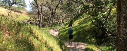
Highlights: The Indian Creek Trail is one of the most picturesque in Shell Ridge Open Space, and this hike provides an easy and scenic way to get to the trailhead!
Directions:  Take Highway 24 towards Walnut Creek and exit at Diablo Blvd. Take Diablo Blvd through downtown Walnut Creek (past Broadway Plaza).  After you pass Broadway, the road will turn into Walker Ave. Continue until you reach Homestead Ave. Take a left.  Then take the first right on Walnut Blvd.  You will see Howe Homestead Park on the left, which is your starting point.
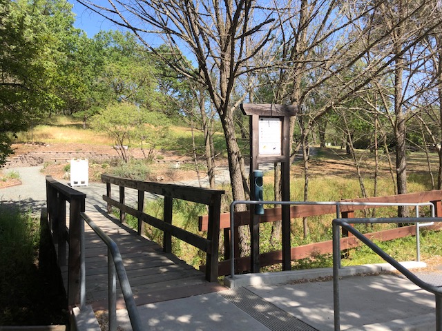
Trailhead:  After parking, you’ll see a kiosk and bridge that crosses into the park.

This isn’t exactly Lamorinda, but easily accessible from the Lamorinda area.. only 10 min or so from the Lafayette BART station.

Most of you have heard of Shell Ridge and likely hiked or maybe mountain biked there before.  But you may not know about the Kovar Trail that starts out of Howe Homestead Park (only 3/4th of a mile East of Broadway Plaza) and leads you right to the beginning of the very picturesque Indian Creek Trail. It’s a perfect pairing!

West End of Shell Ridge Open Space – Click to Enlarge

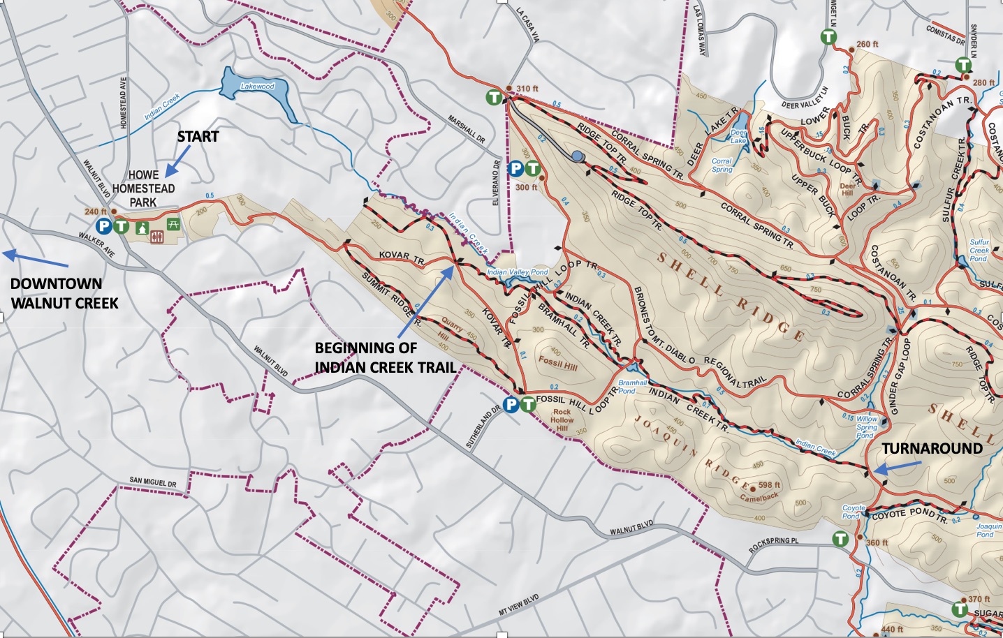
Start the hike by crossing the little bridge and heading up the main trail through the park. Howe Homestead Park is the former home and orchard of James Howe, a foreign correspondent for the Associated Press.  After a short distance you will see a Community Garden on the right with 48 garden plots rented by residents.

Entrance to Howe Homestead Park

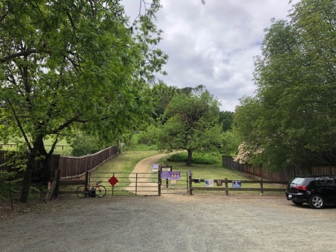
Then you will see the beginning of the Kovar Trail which branches off to the left, as show in the picture.

Beginning of the Kovar Trail

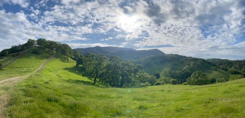
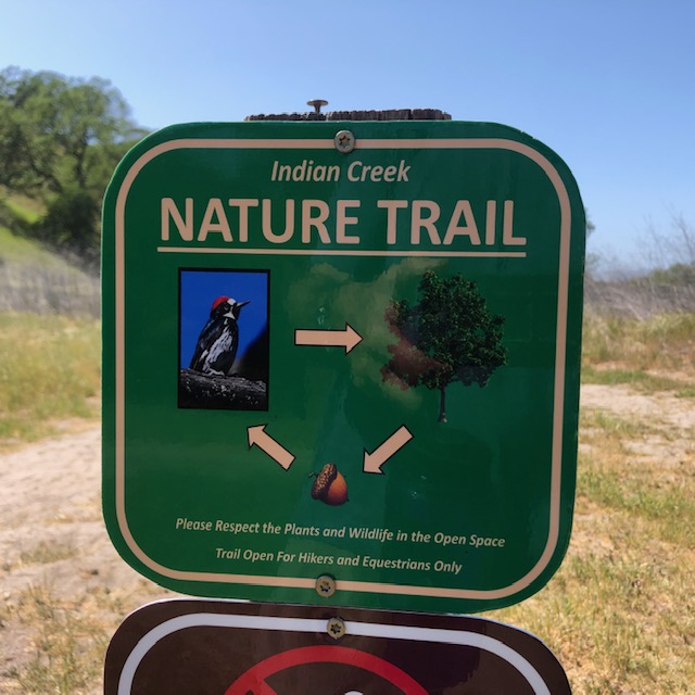
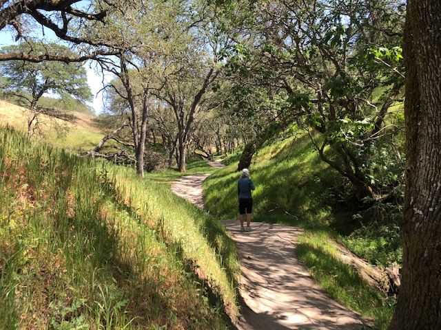
After a short and pleasant descent down the other side, you’ll reach a junction.  The beginning of the Indian Creek Trail is straight across.  So, just go straight. You’ll begin to see signs for the Indian Creek Nature Trail (shown in picture), which is a little over a mile long. The bird shown on the sign is an Acorn Woodpecker and the last time I was on the trail, there were quite a few of them that I noticed.

Indian Creek Natural Trail Sign

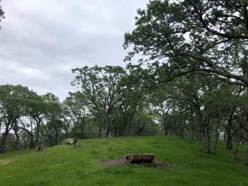
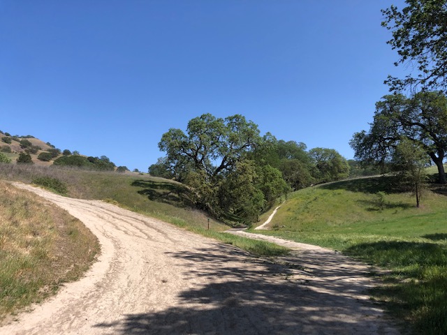
After a couple tenths of a mile, you’ll reach a fire road (Fossil Hill Loop Trail). Take a left, follow it around the corner, then you’ll see the continuation of the Indian Creek veer off to the right (see picture). 

Veer to the right here to continue on the Indian Creek Trail

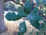
On the rest of the trail you’ll be adjacent to the seasonal Indian Creek.  It’s a bit shaded and very scenic, with a few benches, a bridge, and nice set of stairs at one point.  There are scattered oak trees and most of the ones I examined were blue oaks.  They get their name from the dark blue-green tint of their leaves. Also, a few buckeye trees along the creek.

This is a good example of the Indian Creek Trail

When the trail dead ends at a fire road (Briones to Mt. Diablo Trail) this is the turnaround point for a 4.4 mile hike. You can obviously go further if you’d like – all the way to the top of Mt. Diablo!

At 1420 acres, Shell Ridge is Walnut Creek’s largest open space. It gets its name from the marine fossils left behind when the ocean waters that once covered the area receded. 

Briones Spengler Loop

27 Apr

Length: 6.4 miles
Time: 2.5 hours
Difficulty: Medium
Dogs: Yes!
Calories: ~1000
Elevation Gain: ~1500 feet
Best Season: Winter and spring when the hills are green. Fall can be nice as well.
EMBUD Permit Required:  No
Highlights:  Blue Oak woodland and panoramic views from Briones Crest Trail & Briones Peak
Directions:  From Highway 24 take Pleasant Hill Road exit and head north.  Veer left on Taylor Blvd. Take a left on Withers Avenue. Right on Reliez Valley Road and then you’ll see the Reliez Valley Staging Area on your left.  OR plug “Reliez Valley Staging Area” or “Reliez Valley Trail Head” into your map application.
Trailhead:  At the west end of the small parking lot.

At 6,256 acres, Briones is certainly the largest regional park in the Lamorinda area with multiple points of entry and it’s fun to think that John Muir hiked these hills in the late 1800s.  This staging area and trailhead is especially convenient for anyone living in the Springhill neighborhood of Lafayette, but for others it’s only about a six minute drive from Highway 24 & Pleasant Hill Road (3.5 miles).

Reliez Valley Staging Area

To start the hike head through the gate to begin on the Blue Oak Trail. You’ll ascend through open grasslands with scattered oaks for about a mile until you reach a junction.

Blue Oak Trail (on left) as dusk approaches

You can reach the Spengler Trail either by taking a right on the Blue Oak, up a steep open hill, or continue straight to scramble up the Blue Oak Shortcut, which I prefer.

Blue Oak leaf

Either way, when you reach the Spengler Trail go right.  You’ll be walking through a Blue Oak woodland.  This is the only chance you’ll get to see Blue Oaks on this hike, which are more common the farther you go East. They are the most heat and drought tolerant of our native oaks, and the leaves develop a bluish cast as we progress into summer and fall.  You can identify them by looking closely at one or more of the leaves, which are deciduous, smooth edged, and shallowly lobed (see picture).

Blue Oak woodland at intersection of Spengler and Blue Oak Trail

Ivan Dickson Memorial Trail marker

Continue following the wooded Spengler Trail.  You’ll reach post/marker 49, marker 48, and then marker 46.  You’ll notice on marker 46 “Ivan Dickson Memorial Loop Trail.” This is an 11.7 mile grand loop of Briones Regional Park, in honor of Ivan Dickson.  The loop includes going out to Ivan Dickson Point (near Bear Creek Road) and seeing a special stone bench in his honor.  A passionate hiker and lifelong member of the Berkeley Hiking Club, he left $427K in 1993 for a special gift fund to support a volunteer trail maintenance program that will allow future generations to “take good care of the trails” in perpetuity.

After thanking Ivan, continue straight (angling to the left) on the Spengler Trail. Do not take the Diablo View Trail to the right. You’ll begin to drop into a more lush canyon with the Alhambra Creek (marker 37).  The creek starts in Briones and flows about six miles, through downtown Martinez, and into the Carquinez Strait.

Checking out some lupine near Alhambra Creek

Climb out of the canyon until you reach the Old Briones Road Trail (marker 24), where you’ll take a left.

This is in the vicinity of two vernal ponds, the Maricich Lagoons, which attracts some birds. We actually saw some cows chasing a great blue heron from their field, a sight we were sure we’d never see again.  A long time ago, it was thought that the lagoons represented a vast underground store of water – wishful thinking for sure.

As you climb up the hill you’ll begin to see excellent views north and north-east towards the Carquinez Strait.

When you reach the Briones Crest trail, take a left. After a little over a half of a mile you’ll see a little trail going up the hill to Briones Peak.  This is worth a little detour to stand at the peak (1483 feet) and enjoy panoramic views of the Delta, Mount Diablo, and even Mount Tamalpais.

View of Mt. Diablo from Briones Crest Trail

Once you continue on the Briones Crest trail, you’ll want to stay left and take a connector trail back down to the Spengler.  It’s easy to miss.  If you end up on the Table Top Trail then you missed the left turn.  But if you continue on the Table Top Trail you can add an additional couple of miles to the loop, making it an 8.6 mile loop.

Either way when you reach the Blue Oak Shortcut, take a right and head back the way you came.

Briones Regional Park Map