Archive | Uncategorized RSS feed for this section

Old San Pablo Trail

2 Feb

Length: 3.5 miles or longer if you’d like
Time: 1.5 hours
Difficulty: Easy
Dogs: No
Calories: 500-600
Elevation Gain: 240 feet, fairly flat
Best Season: Any time of year, as long as not muddy
EMBUD Permit Required:  Yes
Highlights:  A surprisingly nice walk parallel to San Pablo Creek with nice views of the San Pablo Reservoir
Directions: Take Camino Pablo northwest from Orinda until you reach Bear Creek Road.  Take a right on Bear Creek and then you’ll see a parking area immediately to the left.  This is the Orinda Connector Staging Area.
Trailhead:  The EMBUD trailhead and sign-in is just past the beginning of the trail.
Map: EBMUD Trail Map

The Old San Pablo Trail runs adjacent to Old San Pablo Dam Road which used to be the main road through the San Pablo Valley before the modern San Pablo Dam Road was built.

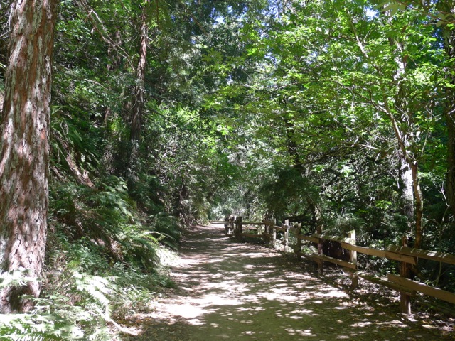
Beginning of the hike

To start the hike, sign in at the EBMUD kiosk and then zig-zag down the rocky trail into the wooded riparian habitat of San Pablo Creek.

After about 2/10ths of a mile you’ll reach an intersection with the Oursan Trail.  I like to go out on the bridge and check out the creek before continuing.  The San Pablo Creek flows for 18.7 miles and drains one of the largest watersheds in the East Bay with 34 named tributaries.  The creek was dammed in 1919 forming the San Pablo Reservoir.  If you continue on Oursan Trail you’ll reach a meadow with large pine trees and a few scattered picnic tables, which would be a nice spot for a picnic lunch with kids.

But for the hike described here, we will continue on Old San Pablo Trail.

After a half mile you’ll reach EBMUD Watershed Headquarters.  This is a convenient spot to pick up a trail permit if you don’t already have one.

EBMUD Watershed Office

Before long, you’ll begin enjoying wonderful views of San Pablo Reservoir.  The Reservoir was built in 1919 by the East Bay Water Co., a predecessor of EBMUD.  The reservoir refused to fill up during the first ten years until they started piping water from the Pardee Reservoir in the Sierras.  Today it provides water for 20% of EBMUD’s customers.   You may notice ducks and geese who winter here and herons and egrets who raise their young along the shores.

View of San Pablo Reservoir

The trail winds through a combination of oak, Monterey pine, and California bay trees.

At 1.7 miles (and roughly 45 minutes) you’ll reach Old San Pablo Dam Road.  This is where I normally turn around.

If you cross the road, you’ll reach the intersection with Inspiration Trail.  If you’re looking for a more rigorous hike, you can take that trail to the left (which is mainly fire roads) for about 2 miles and you’ll climb up to Inspiration Point (1040 feet of elevation) or you can go right and continue on Old San Pablo Trail for almost four more miles, passing the marina, all the way to the dam and Kennedy Grove Regional Recreation Area.

Map showing first 1.7 miles on the Old San Pablo Trail starting from the Orinda Connector Staging Area.


Carr Ranch Loop Trail

16 Jan

Length: 8.3 miles from parking lot
Time: 3.5-4 hours
Difficulty: Strenuous (see elevation map at bottom)
Dogs: Yes, on a leash
Calories:
1300
Elevation Gain: 2074 feet, lots of climbing
Best Season: Winter or Spring after a couple weeks without rain – to avoid mud
EMBUD Permit Required: Yes
To Bring Along: Plenty of water and a snack
Highlights:  Explore the newest open space around Lamorinda – Carr Ranch! 604 acres just opened on October 14th, 2017. Perfect if you’re looking to get away from it all and want a real workout.
Directions: Take Canyon Road south from Moraga. Take a left on Camino Pablo and take it all the way until you reach Rancho Laguna Park. Park in the parking lot just past Knoll Drive.
Trailhead: The EMBUD trailhead and sign-in is at the back of the park.

Carr Ranch was owned for over 100 years by the Carr Family. Muir Land Trust was able to purchase it in November 2016 with the help of $7 million in donations received from individuals, foundations, agencies, and businesses. The 604 acres of unspoiled ranch and wild lands is now permanently protected and open for us all to enjoy! The only prior inhabitants of Carr Ranch have been wildlife and cows grazing.

To start the hike, walk to the back of Rancho Laguna Park and you’ll see an EBMUD sign-in kiosk and gate. To access the Carr Ranch Loop Trail you need to take the EBMUD Rocky Ridge Trail for about 2 miles.  Official Carr Ranch Trail Map…

Beginning of Rocky Ridge Trail

After climbing a little hill you’ll take a right on the Rancho Laguna Trail and go about .4 miles to reach a sign for the Rocky Ridge Trail (heading East).

The trail runs adjacent to a creek and then ascends through a forest of coast live oak and bay laurel trees. You may notice many logs on the ground with bracket fungi growing on them (see picture).  Over 1000 varieties have been discovered!  These and other decomposer fungi are the first step in food chains that feed on decomposed plant material. Anyway, then you’ll emerge onto a high meadow and continue climbing to the top of the first hill at 1097 feet.

Hiking up through oak and bay laurel woodlands

Bracket fungi on fallen trees

After descending down the other side, and hiking about 2 miles or so, you’ll reach the year-round Buckhorn Creek, an untouched riparian habitat. It drains into the Upper San Leandro Reservoir and so all of this land is part of the huge watershed for the Reservoir. And as you cross the creek, imagine for a moment that you’re far under water. It could have been. At one point in the late 80’s EBMUD proposed to build a new reservoir in the Buckhorn Creek Valley, but fortunately it was opposed and finally shelved.

Standing next to Buckhorn Creek

After another tenth of a mile, you’ll reach the turn off to the Carr Ranch Loop Trail (see picture). Take a left, instead of zig-zagging up the hill, and soon you’ll reach the 3.5 mile loop. We went to the right, hiking the loop counter-clockwise.

Turn off to Carr Ranch Loop Trail – about two miles from the start and a tenth of a mile past Buckhorn Creek

During the first part of the loop you’ll hike through the trees, adjacent to Buckhorn Creek. We noticed many, many acorns on the ground, which were a staple for the Native Americans that lived in this area.

Beginning of the Carr Ranch Loop Trail

Tons of acorns!

Soon you’ll begin climbing and climbing, up, up, up to the ridge that surrounds the valley. At about 4.5 miles of hiking you’ll reach the high point of 1275 feet. There is a fire road heading off to the right that actually leads to the back of St. Mary’s College. But the Loop Trail continues straight. Enjoy the vistas of undeveloped land in all directions!

View of Carr Ranch – about half way through the hike

Approaching the summit of 1275 feet

After another mile and a half you’ll reach the junction where you started on the loop. Return the same way that you came.

During your hike you may notice a shrub that looks like this (picture) and somehow thrives on these dry hillsides. It’s called Coyote Brush. Like all native plants it has evolved to survive without water from May through October. We have shifted most of our yard to native plants and have a couple large Coyote Brush plants that seeded themselves and didn’t cost us a penny!

Coyote Brush

One other thing you might notice is that there is almost no noise of any kind on Carr Ranch, except for planes flying overhead. Unfortunately there is a bit of a highway overhead with planes heading East from SFO and Oakland. This is becoming a bigger and bigger issue. Save Our Skies is fighting to protect our skies in the East Bay.  Their motto is “Too many, too loud, too often”.

You may encounter cows on this trail. No worries. Just walk in a wide arc around them and make sure not to get between a mother and a new calf. EBMUD and the East Bay Regional Park District both lease some grassland areas for cattle grazing. This is to keep the grass height down, which lessens the fire hazard during the dry season.

Muir Land Trust has now protected over 3,000 acres in the East Bay, all dedicated to open space forever! Learn more at www.jmlt.org.

McCosker Loop Trail

28 Dec

Length: 2.6 mile loop, starting at staging area
Time: About an hour
Difficulty: Medium
Dogs: Sorry, not allowed in this part of Sibley
Calories:
400-450
Elevation Gain: 581 feet. Starts at about 750 feet and climbs to about 1250 feet.
Best Season: Avoid after heavy rains (likely muddy) or very hot days.
EMBUD Permit Required: No
To Bring Along: Binoculars, plenty of birds and views
Highlights:  Check out a brand new staging area and hike that none of your friends know about! Reach many nice viewpoints with vistas of mostly undeveloped land, including the summit of the hike, about mid way through.
Directions:  Take Canyon Road south from Moraga. When you reach Pinehurst Road, take a right. Drive about one mile past the Canyon Elementary School and look for the new Wilcox Staging Area on your right. There are roughly 10 parking spots.
Trailhead: Just walk up the gravel road to reach the trailhead.

NOTICE: The Wilcox Staging Area is currently closed for a significant creek restoration (Jan 2021).

The Wilcox Station Staging Area and McCosker Loop Trail are brand new additions to the Sibley Volcanic Preserve. If you look at the Sibley map, you’ll now see them on the far right side.

A little quick history.. The 250+ acres that have been appended to Sibley were settled by the McCosker family in the 1870s, initially as a ranch, and later as a paving and quarry operation from the 1950s-70s. The land was part of 1300 acres that were purchased by the Wilder Development (245 home sites) and then donated to East Bay Regional Parks and EBMUD in 2011. A huge thanks is due to a group of Orinda citizens called Save Open Space and assistance from the Golden Gate Audubon Society. The story is covered in a recent Lamorinda Weekly article and Audubon Society blog post.

Wilcox Station Staging Area on Pinehurst Road (notice NO DOGS sign)

The Wilcox Station Staging Area, where you can park, is near the former Wilcox Station, part of the Sacramento Northern Railroad, an electric train that ran for 183 miles from Oakland all the way to Chico. Trains traveled through the one mile long “Redwood Peak Tunnel” from Shepherd Canyon on the Oakland side, before emerging in the canyon near the hairpin turn on Pinehurst Road.  A 1917 map shows the very first stop as Eastport Station (eastern portal) and the second stop as Wilcox Station.  The tiny town of Eastport still shows up in Wikipedia and on Google Maps!

Map of the McCosker Loop Trail

To begin the hike, just head up the gravel road. After a couple tenths of a mile you’ll reach a gate, where you take a sharp right. You’ll then pass a large metal barn that now houses EBRPD equipment. Just up the hill you’ll reach the beginning of the two-mile loop trail. You can hike in either direction, but our group went right.

Just follow the trail signs!

Hiking through woodlands (with my family on the day before Christmas)

During the beginning and end of the loop you’ll pass through oak/bay laurel woodlands and then as you reach higher elevations it will be mostly open grassy hills used for cow grazing. As far as trees go, you’ll mostly see Coast live oak and California bay laurel, but may also spot Pacific madrone, Coast redwood, Giant sequoia (planted), California buckeye, and some alders by the parking lot.

Coast live oak trees

After just a short while you’ll reach a picnic table (picture below) and then a little further you’ll pass a random patch of redwood trees on the right.

Unexpected picnic spot!

While hiking we had the amazing experience of seeing direct descendants of dinosaurs, that can fly, commonly known as birds. In just an hour we spotted swallows, crows, doves, scrub jays, anna’s hummingbirds, warblers, sparrows, and a red-tailed hawk. According to an EBRP study, this new addition to Sibley has the potential to support about 300 species of birds, mammals, reptiles, and amphibians, almost half of which are birds. Common birds of Northern CA…

Trail ascending towards summit

After a surprisingly steep climb and about 30-40 minutes of hiking you’ll reach a summit of about 1250 feet. The old ranch dirt road splits into two at the top. Stay to the right, and then you’ll begin to descend. The views at the top are fantastic!

Checking out view towards Sibley’s Round Top

To the north you’ll be able to see Sibley’s Round Top in the distance. In the future, the new McCosker portion of the park will be fully connected to the rest of Sibley Volcanic Preserve, The Wilder Development, and Orinda.

Pennyroyal in full bloom

On our hike we stumbled upon a couple of wild herbs that are fun to smell: pennyroyal and wild fennel.   Pennyroyal is a non-native perennial, which is a member of the mint family and quite common on the hike.

Soon the trail will reach the junction where the loop started, and then you return past the large metal barn the same way you came.

Note: You may encounter cows on this trail. No worries. Just walk in a wide arc around them and make sure not to get between a mother and a new calf. EBMUD and the East Bay Regional Park District both lease some grassland areas for cattle grazing. This is to keep the grass height down, which lessens the fire hazard during the dry season.

McCosker area map with hiking loop shown in red

Elevation map

Oursan Trail in the Fall

19 Nov

I just hiked the Oursan Trail, on the north side of Briones Reservoir, last Saturday.  This is a really nice, up-lifting hike in the fall when it’s a little cool (60’s) and you want to be in the sun.  Just make sure the trail has had time to dry out from any recent rain and isn’t too muddy.  You’ll love all the views of Briones Reservoir shimmering in the sun!

EBMUD is considering opening up some of their trails, like Oursan, to mountain bikers.  Here’s a link to a recent article in the CC Times.

Click here for a full description of this hike.  Remember to bring your EBMUD pass.

Oursan-Nov15

Oursan-Nov15-2

Oursan-Map2-Text

This is going out about an hour ( 3.1 miles in this case) and turning around for a total of 6.2 miles.

Lafayette Ridge Feeder Loops

28 Feb

The Lafayette Ridge Trail is one of the most popular trails in Lamorinda due to the convenience of the Lafayette Ridge Staging Area on Pleasant Hill Road, across from Acalanes High School. But what many area residents may not know is that there are a number of Lafayette Ridge “feeder” trails, some named after famous residents, that can be used to create more unusual loops and routes.

I’ve created an overview map that shows the entire Lafayette Ridge Trail and all the feeder trails including (from East to West):

– Las Trampas to Briones Regional Trail (from Deer Hill Road)
– Petar Jakovina Trail (from downtown, 1st Street or Brown Street)
– John Kiefer Trail (from Springhill neighborhood)
– Springhill Trail (from end of Springhill Road)
– Buckeye Ranch Trail (from end of Springhill Road)
– Mariposa Trail (from end of Panorama Drive – across from Happy Valley Elementary)

Lafayette Ridge Feeder Map Med

Lafayette Ridge Feeder Trails


These feeder trails can be combined in different ways. A few combinations that I’ve tried:

John Kiefer Loop

Distance: 3.2 miles
Time: 1:15
Difficulty: Medium, a couple steep spots going up the Lafayette Ridge
Calories: 500
Dogs Allowed: Yes

John Kiefer Loop

John Kiefer Loop

Start at the Lafayette Ridge Staging Area off of Pleasant Hill Road. Follow the fire road up the hill following the signs for the Lafayette Ridge Trail. You’ll pass an old barn on the left and then reach a junction with the Las Trampas to Briones Regional Trail. Make sure to stay right and keep going up the hill. After a steep section you’ll reach a cow gate. Go through the gate and stay to the left on a single-track trail.   This scenic section of the trail runs just above a neighborhood and then brings you to a crest and junction with the Petar Jakovina Trail.   Turn to the right on the fire road that runs along the Ridge. Very soon you’ll see two large water tanks up on the hill followed by three large pine trees. Just past the pine trees there is a City of Lafayette trail marker (see picture). Take a right up the hill. If you’ve gone the right way you’ll quickly reach a fantastic bench and view spot under one of the pine trees.   This bench is your high point on the hike at about 1000 feet (parking lot is at 367 feet).

This slideshow requires JavaScript.

After a break continue on the trail and right away you’ll reach another bench that looks out over the Springhill neighborhood and beyond (see picture). Follow the trail through a forest of oaks, maples, and bay laurel trees. After about 3/10ths of a mile you’ll reach Leslyn Lane. Take a left down the steep but scenic road. You’ll reach Goyak Drive and then Springhill Road. Luckily the City has recently added a walking path along Springhill Road from this point all the way down to Springhill Elementary School. If school is not in session you can cut through the school back to the Staging Area where you started.

The John Kiefer Trail was just named and dedicated to “Papa John” Kiefer on July 27, 2014. John is a local hero, best known for being Lafayette’s chicken expert and offering free chicken workshops every year, but prior to that he was a Parks, Trails & Recreation Commissioner from 1986 to 1994. During that time he supervised the construction of two Lafayette Ridge feeder trails, and also created the Volunteer Trails Maintenance Program in 1995.

View city brochure about the John Kiefer Trail

View article in the Lamorinda Weekly about the creation and dedication of the trail.


Petar Jakovina Loop (or the “Stairmaster Loop”)

Distance: 2.8 miles
Time: 1:15
Difficulty: Challenging. A steep approach to the trail on Sessions Road and then about 75 steps going up the Petar Jakovina Trail and another 75 steps coming down the Las Trampas to Briones Regional Trail.
Calories: 400-500
Dogs Allowed: Yes

The Petar Jakovina Loop combines the Petar Jakovina Trail and the Las Trampas to Briones Regional Trail into a three mile loop that starts near downtown Lafayette and can be done in either direction. I jokingly refer to this as the “Stairmaster Loop” because both feeder trails include about 75 steps. It’s easier to climb the Regional Trail (from Elizabeth Street), but can be a little sketchy to come down the Jakovina Trail if there are a lot of leaves.   If you go up the Jakovina then get ready for a scenic “Stairmaster” workout!!

Petar Jakovina Loop

Petar Jakovina Loop

Directions for going up the Peter Jakovina Trail:

I typically park on Brown Avenue under Highway 24. Cross Deer Hill Road to Miller Drive. Follow Miller Drive to Sierra Vista Way.   After about a quarter mile you’ll see a sign for private Sessions Road on the right.   Sorry, Sessions Road is steep, but after about 100 yards you’ll see a trailhead on the left. That is the beginning of the trail.   Soon after the trail begins you’ll reach a nice bench under an oak tree where you can enjoy the view out over Lafayette and recover from climbing Sessions Road!! The trail traverses a canyon with oaks, bay laurels and buckeye trees and like I mentioned before has about 75 steps. On the way up you’ll cross the upper end of Sessions Road and then continue on the other side. Near the top you’ll reach a fire road where you take a right and continue up to a junction with the Lafayette Ridge Trail.

This slideshow requires JavaScript.

Make sure to take a right on the single-track trail that angles down behind a house. After a third of a mile or so you’ll reach a cow gate where the trail turns into a fire road.   At this point you can enjoy great views of Mt. Diablo in the distance! After descending down a steep rocky section you’ll reach a junction. Take a right on the Las Trampas to Briones Regional Trail that heads down the hill. You’ll know you’ve gone the right way when you reach the first of many series of steps. This surprisingly scenic trail descends down through the trees towards Highway 24. When you reach Deer Hill Road, follow the signs to continue along the street back to Brown Ave. where you started.

The trail was dedicated to Petar Jakovina in 1996 because he helped make land available for the trail. Petar is most famous in Lafayette for opening Petar’s Restaurant in 1959, calling it “a little bit of San Francisco in Lafayette.” In 1980 he moved the restaurant to Lafayette Circle where it stayed until 2013, and became a popular spot to listen to dance songs by “Diamond Dave.” The site is now occupied by the Cooperage.

View city brochure about the Peter Jakovina Trail


Other Ideas:

If you live in the Springhill neighborhood you could hike to downtown (for lunch?) by going up the John Kiefer Trail, take a left on the Ridge Trail, and then going down the Petar Jakovina Trail. Take a right on Sierra Vista Way, which will turn into 1st Street and take you by Whole Foods.

If there are any other good feeder loops that you’d recommend please comment on this post.

Revisiting the Russell Peak Loop

22 Feb

I just hiked the Russell Peak Loop yesterday for the umpteenth time and felt compelled to draw attention to it again.  This is an easily accessible hike that starts near Happy Valley Elementary School in Lafayette and winds up to Russell Peak (1357 feet) in Briones Regional Park.  The views from the top are incredible!  You can see the north Bay, Mt. Tamalpais, Briones Reservoir, Round Top at Sibley, Rocky Ridge, Mt. Diablo, and more.  This is a great hike to do from Feb-May while the hills are green.  I just added a few more details to the original post.

Russell-Peak-Map-Marked


Rocky Ridge Trail

3 Feb

Length: Up to 7.6 miles roundtrip, but you can turn around whenever you want.
Time: About 3 hours for the full roundtrip. This is an out-and-back so when you’ve hiked half as long as you want to go, then turn around.
Difficulty: Challenging. Two fairly steep climbs (500 and 600 feet) on the way towards Rocky Ridge. Just one 400 foot climb on the way back.
Dogs: No
Calories:
Around 1100 (for the full distance)
Elevation Gain: 1271 feet on the way out and 500-600 feet on the way back.
Best Season: Spring – when the wild flowers are blooming. Not recommended when it’s hot.
EMBUD Permit Required: Yes
Highlights:  The Rocky Ridge Trail takes you into one of the most unspoiled, remote areas in the East Bay, on a huge piece of EBMUD watershed land between Las Trampas Regional Wilderness and the Upper San Leandro Reservoir. This is your chance to see what the East Bay looked like before it was developed!
Directions:  Take Canyon Road south from Moraga. Take a left on Camino Pablo and take it all the way until you reach Rancho Laguna Park. Park in the parking lot just past Knoll Drive.
Trailhead:  The EMBUD trailhead and sign-in is at the back of the park.
Special Notes: This hike is challenging and mostly exposed to the sun, so bring sun protection, plenty of water, good hiking shoes/boots, and a snack.


About Rocky Ridge… Rocky Ridge is one of the highest points in the East Bay, at just over 2000 feet, and provides a commanding vantage point. It was actually a Nike missile site during the Cold War in the late 50’s. It is most often accessed from the staging area at the end of Bolinger Canyon Road (off of Crow Canyon) and then by heading up the paved Rocky Ridge View Trail. But the trail I’m going to describe approaches Rocky Ridge from EBMUD watershed land on the remote west side.

Rocky Ridge has an interesting geological history. For millions of years, this area was a shallow sea and erosion from adjacent highlands built up thick layers of sediment. About 3-4 million years ago, these rock layers were thrust up to create the high ridge that we now see. The west-facing slope exposes the edges of many rock layers that were originally sediment under water.

The full Rocky Ridge Trail begins at Valle Vista Staging Area and is 6.15 miles long one way, so I prefer to start at Rancho Laguna Park, making it 3.8 miles one way and 7.6 roundtrip (if you go to the end).

To start the hike, sign in with your EBMUD permit number and proceed through the gate. After climbing a little hill you’ll take a right on a fire road and go about .4 miles to reach a sign for Rocky Ridge Trail (heading East).

Rocky-Ridge-Start

Beginning of hike

The trail starts out fairly level, running adjacent to a creek on the right. Soon you’ll be climbing through a forest of oak and bay laurel trees. Then you’ll emerge onto a high meadow and continue climbing to the top of the first hill at 1097 feet. In the spring, the meadow and summit are littered with wildflowers and you might feel tempted to start singing “The hills are alive with…” from the Sound of Music. This first summit is a great spot to take in the view back towards Moraga and also to the east to see a terrific view of Rocky Ridge.

View of Rocky Ridge from top of first hill

View of Rocky Ridge from top of first hill

Beyond the crest, the trail descends down to the valley below. You’ll reach a fire road, where you take a left, and then right away see a sign for Rocky Ridge Trail pointing to the right.   You’ll soon reach Buckhorn Creek and an untouched riparian habitat.

Buckhorn Creek

Buckhorn Creek

Buckhorn Creek drains into the Upper San Leandro Reservoir (completed in 1926), that you may have seen if you’ve ever hiked the Kings Canyon Trail from the Valle Vista Staging Area. This is why all of this is EBMUD land–because it is part of the huge watershed for the reservoir. There was actually a fierce battle in the late 80’s over EBMUD’s plan to put a new reservoir in the Buckhorn Creek valley. The plan was finally shelved leaving the valley in its natural state.

The second climb

The second climb

Coyote-Brush

Coyote Brush

After admiring the creek, it’s time to begin climbing again. This time you’ll zig-zag up a grassy slope, with about 600 feet of elevation gain, until reaching an even higher crest of 1261 feet. On your way up you may notice a shrub (see the picture) that somehow colonizes and survives on these dry hillsides. It’s called Coyote Brush. I actually have some growing in my back yard and this lets me know that it really is native to the area and can survive with almost no water from May-October. All native plants have evolved to survive fine in this area without any assistance from us (e.g. irrigation) and thus are ideal for a maintenance free yard.

Once you reach the top of this second summit you’ll begin to be able to see the San Francisco Bay in the distance.

Views of the San Francisco Bay from the top of the second hill

Views of the San Francisco Bay from the top of the second hill

You’ll reach a cattle gate where the trail meets a dirt road. Stay left and in about 3/4ths of a mile you’ll reach the Rocky Ridge Loop Trail, which circles around Rocky Ridge. On this last stretch you will have great views of the west face of Rocky Ridge and may also notice a cool looking peak to the south. That’s Ramage Peak (see picture). I haven’t been there yet, but it’s supposed to be a really neat spot! It can be visited from the seldom used Ramage Peak Trail.

View of Ramage Peak through barbed wire fence - nearing the end of the trail

View of Ramage Peak through barbed wire fence – nearing the end of the trail

At the junction with Rocky Ridge Loop Trail, you’re about 3.8 miles from the start and it’s time to turn around, unless you decide to turn around sooner.

Return the way you came.

You may encounter cows on this trail. No worries. Just walk in a wide arc around them and make sure not to get between a mother and a new calf. EBMUD and the East Bay Regional Park District both lease some grassland areas for cattle grazing. This is to keep the grass height down, which lessens the fire hazard during the dry season.

Rocky-Ridge-Map

Rocky-Ridge-Topo


French Trail Loop

6 Jul

Length: 6.4 miles (can shorten to 4 mile loop)
Time: About 2.5 hours
Difficulty: Medium.
Dogs: Yes – on a leash
Calories:
Around 1000
Elevation Gain: 1,534 feet
HighlightsRedwood Regional Park is my favorite park in the East Bay, containing the largest remaining natural stand of coast redwood found in the East Bay.  This shady loop offers a nice sampler of some of the best sections and trails in the park.  The first half of the hike follows the Stream Trail with majestic redwoods along Redwood Creek.  The second half traverses the scenic “uplands” of the park along the popular French Trail.  This hike can be done in either direction.
DirectionsFrom Moraga take Canyon Road south until reaching Pinehurst.  Take a left on Pinehurst and wind over the hill until reaching Redwood Road.  Take a right.  The park entrance will soon appear on your right.    Park in the first parking lot on the left after you see the “Fishway” area and sign.  $5 parking fee on weekends.
From the Oakland side take Highway 13 to the Carson Street/Redwood Road exit.  Go East on Redwood Road for 3.2 miles until reaching the park entrance, passing Skyline Blvd on the way.  Turn left into the park.  Park in the first parking lot on the left after you see the “Fishway” area and sign.  $5 parking fee on weekends.
Trailhead:  The hike starts at the Fishway area.
Special Notes:  There is quite a bit of poison oak along the French Trail so be careful or consider wearing long lightweight pants.

This hike isn’t technically in the Lamorinda area, but I figured I should write a post about it since I recommended it for an article in the Contra Costa Times titled “Bay Area’s best hiking trails” published on Sunday, July 6th, 2014.
View article…

Redwood-Entrance

Before starting your hike take a minute to check out the interpretive signs about Rainbow Trout.  The world-famous rainbow trout were first identified as a distinct species from fish taken from San Leandro Creek drainage, of which Redwood Creek is a tributary.  The trout that spawn in Redwood Creek today are descendants of that pure strain of native trout.

Redwood-Fish-InterpretiveRedwood-Trout
(Fishway interpretive area shown above)

Make sure to grab a map.  Redwood Park is a maze of trails and it is very easy to take a wrong turn.  So at each intersection double check the trail posts to ensure you’re going the right way.  Link to park map…

To start the hike, cross the bridge and take a right on the Bridle Trail.  Bridle Trail runs adjacent to Redwood Creek and bypasses the main parking lot and busy picnic areas.  After about a half mile you may notice that the second group of redwood trees on the right appears to be in a circle (see picture).  This is called a “fairy ring.”    Redwoods sprout from the stumps or roots of existing trees.  When the original tree dies, the surrounding shoots may develop into mature trees in a circle around the ancient parent.  Try to imagine the old growth tree that would have been in the middle of the circle!

Redwood-BridleRedwood-Fairy-Ring
(Bridle Trail on left and a “Fairy Ring” of redwoods on the right)

You’ll reach a connector to the main Stream Trail, but you’ll want to stay left on the Bridle Trail.  The trail will climb just a little and you’ll see the Stream Trail down to your right as you hike just above it.  At one point there is an unmarked trail heading left, but you’ll want to go right and continue paralleling the Stream Trail.    At about 1.5 miles The Bridle Trail will merge into Stream Trail (at the intersection with the Chown Trail).

Option for a 4 mile loop: After reaching the Stream Trail, go about a quarter mile and instead of going straight take a left on the Fern Trail, climb to the French Trail, and take a left.   This will cut a little over 2 miles from the loop.

Redwood-Stream

Stream Trail

For the full 6.4 mile loop continue on Stream Trail – the “spine” of the park.  The largest redwoods along the creek are second and third growth descendants from a virgin, old-growth forest, just like Muir Woods, that was completely logged between 1840-1860, then logged again after the 1906 earthquake.  So, the tallest trees are only about 100 years old.  But that is long enough for many of them to have grown over 100 feet tall!   Left undisturbed these amazing trees can live over 1000 years and grow to be over 300 feet tall.

At a little over 2.5 miles you’ll reach the intersection with Tres Sendas Trail (translates from Spanish to three paths).  This is one of the most scenic spots in the park.  Take a left on Tres Sendas Trail and then take a break at the bench on the right, a perfect place to rest, have a snack, and take in the view.

Bench near intersection of Stream and Tres Sendas Trails

Bench near intersection of Stream and Tres Sendas Trails

After just a tenth of a mile on the Tres Sendas Trail take a left on Starflower Trail.  Get ready for one of the main climbing sections of the hike, but it’s only about a third of a mile.  When you reach the French Trail, take a left.

The French Trail winds along the western “uplands” of the park back in the direction you came.  You’ll continue to see many redwoods, but also many California Bay Laurel trees and a few oak trees in the sunniest spots.  When the French Trail intersects with the Chown Trail, make sure to follow the sign pointing left to stay on the French Trail.

Hiking along the French Trail

Hiking along the French Trail

Along the French Trail and throughout the park, you’ll see ferns everywhere.  This is an amazing family of plants.  Ferns first appear in the fossil record 360 million years ago and now there are 12,000 different species of ferns.  Ferns reproduce via spores and have neither seeds nor flowers.  They tend to grow in areas where it is challenging for flowering plants to survive.  You will see two types of ferns in the park:  the western sword fern and the wood fern.  See the picture of each type.

Fern-SwordFern-Wood
(Western Sword Fern on left, Wood Fern on right)

After about 2.7 miles on the French Trail, you’ll reach Orchard Trail.  Take a left, descending back down to the Bridle Trail.  Take a right at Bridle Trail and return to the Fishway area.

An interesting piece of history:  when Alameda County was split off from Contra Costa County in 1853, the border was put right through the center of these redwood lands, because both counties realized the value of the forest and didn’t want to give it up.


Redwood-Map

Link to park map…

There are an unlimited number of loops that you can create in Redwood Park.  Just grab a map and plan a route from whatever staging area you start from.


Oursan Trail

14 Apr

Length: 1 – 10 miles (go as far as you want and turn around)
Time:  2 hours for a 5 mile hike
Difficulty: Easy to Moderate.
Elevation Gain:  Fairly flat trail with a few little hills
Dogs:  Yes, but must be kept on a leash at all times.  This is one of the few EBMUD trails that allows dogs.
Best Season: Spring!
EBMUD Permit:  Required
Calories: Around 900 calories for a two hour hike
Highlights:  The Oursan Trail skirts the northern shores of Briones Reservoir, through open fields and scattered oak trees and is one of the most serene hikes in the East Bay.  It is especially stunning in the spring when the meadows are green with wildflowers and the direct sun is welcome.
Directions to Bear Creek Trailhead (from Lafayette):  From Lafayette take Happy Valley Road up over the hill to Bear Creek Road.  Take a right and then a quick left into the Bear Creek Staging Area.   This staging area is on the opposite side of the road from the entrance to Briones Regional Park.
Trailhead:  Once you have parked look for the gate and trailhead on the right/north side of the parking lot.  The Bear Creek Trail starts on the other side.

This is the best hike in Lamorinda for walking adjacent to a reservoir besides the Lafayette Reservoir, which is far more crowded.  You’ll see a few people on this trail on the weekend, but it is very lightly used.  The name “Oursan” is as lightly used as the trail.  It means “small bear” in French, but I’m not sure when or why it  was chosen.

Briones Dam was built in 1964 to supply growing central Contra Costa County with water (that’s us!).  The Reservoir is very deep and the largest of EBMUD’s reservoirs with a total capacity of 19.7 billion gallons of water.  EBMUD manages the reservoir and the watershed land that surrounds it.  Local runoff into all five reservoirs satisfies about 5% of the East Bay’s water needs.  The rest comes from the Pardee Reservoir in the Sierra.

To start the hike, go through the gate, sign in at the registration kiosk with your permit number, etc. and then proceed on the fire road.  The trail climbs steeply from the trailhead over a small hill, then opens up to a view of the reservoir.

Oursan-poppys

First view of the reservoir.

You will pass a giant oak on your left with large clumps of mistletoe.  We commonly think of mistletoe sprigs as something you hang at Christmas time to kiss under.   Mistletoe is actually a very large family of parasitic plants that attach to and penetrate the branches of a tree or shrub, through which they absorb water and nutrients.  For a long time, Mistletoe was limited to the foothills around the Central Valley but today it is commonly found throughout the Bay Area and seen in many mature Oak trees in the East Bay.

Besides the big oak tree you may be flanked by hundreds of California Poppies.   They flower from February through September, but spring is when they put on the best show.  This is the flower pictured on welcome signs when you enter California!  It was selected as the state flower in 1890, as its golden blooms were deemed a fitting symbol for the Golden State.  April 6th is California Poppy Day.  A few fun facts about the poppy:

  • The petals close at night or in cold, windy weather and open again the following morning.
  • Poppy leaves were used medicinally by Native Americans, and the pollen was used cosmetically.
  • It is drought-tolerant, self-seeding, and easy to grow in gardens.

Besides poppies, you are likely to see buttercups (small yellow flowers), lupine, and blue-eyed grass.

After passing by the lake’s edge, the trail will take an up-and-down course around two fingers of the lake, often under a canopy of oak trees.   You may notice a nest box for wood ducks.  In many areas, wood ducks have difficulty finding suitable natural nesting sites. These boxes provide a man-made alternative, where hens can nest in relative safety from predators.

Oursan-oaks

Red-winged Blackbird

Ducks are just one type of bird you might see.  In the open areas you may see red-tailed hawks, red-shouldered hawks, or turkey vultures flying high above.  In wooded areas you may see varied thrush, western scrub-jays, and band-tailed pigeons.  In the water look for ducks and grebes foraging near the shoreline. On a recent hike (April 2020), we kept seeing red-winged blackbirds along the edge of the lake on and around cattail (see picture).

After about a mile, the trail emerges from the trees and runs out in the open, along the water, for another mile or so.    You will have many excellent views of the shimmering blue water and may think it would be great for swimming or boating, but it is not open for recreational use.  There is one exception:  it is used by the Mills College, UC Berkeley and Saint Mary’s College rowing teams, which I’ve seen on one occasion.

Oursan-Reservoir-View

Keep track of your time and turn around when you have hiked half as long or half as far as you want to go.  I typically hike about an hour and then turn around.    At 5.4 miles you reach the Hampton Trail, which connects to the Hampton Staging Area.  The Oursan Trail actually continues for a lengthy 10.4 miles, ending at San Pablo Dam Road.  If you’re really up for a multi-hour adventure you can connect to the Bear Creek Trail and complete a 14 mile loop around the entire reservoir.

Selfie picture at turnaround point with friends Rick & Alicia!

Selfie picture at turnaround point with friends Rick & Alicia!


Oursan-Map

Springhill Sunrise Loop

7 Apr

Length: 4.5-5 miles
Time:  2 hours
Difficulty: Moderately Strenuous (similar to Reservoir Rim Trail)
Elevation Gain:  748 feet
Dogs:  Allowed
EBMUD Permit:  Not Required
Calories: Around 1200
Highlights:  This hike in the southeast corner of Briones Regional Park, offers a good workout, sort of like the Rim Trail, with stunning views out towards Mt. Diablo and over Lafayette, and some beautiful forests of oak trees.  It’s especially good in the spring when the hills are green.
Directions:  From Highway 24, get off at Pleasant Hill Road and go north.  Take a left on Springhill Road and take it to the very end (a couple miles).  Just before the road ends you’ll see a fire road gate and cars parked on the right side.  The end of Springhill Road is best known for the Girl Scouts camp, called Twin Canyon, that’s been here since 1954.   Map…
Trailhead:   To begin the hike, pass through the gate.

Right after going through the gate, you’ll see a sign saying “Future Site of Buckeye Ranch Staging Area.”  Apparently this area is the site of a former dude ranch – maybe called “Buckeye Ranch?”  I’m not sure when they plan to build a staging area, but it seems OK as it is.  There just aren’t any Briones trail maps to grab.

This slideshow requires JavaScript.

Start your hike by veering to the right on the Buckeye Ranch Trail versus going straight up the hill in front of you on the Springhill Trail, which is where you’ll come down.   The Buckeye Ranch Trail runs alongside a creek with a pleasant canopy of oak trees.  After about a half mile of hiking you’ll reach a gate.  Once through the gate, hang a sharp right and follow signs for the Sunrise Trail.  Now you’ll be walking back in the same direction on the opposite side of the creek.   This section is flat and surprisingly scenic – a magical oak forest!

A little about oak trees…  Seven species of oak trees comprise most of the oaks you’ll see in the East Bay.  These are amazing trees.   They have evolved to survive with almost no rain for six months of the year and a mature tree can produce thousands of acorns in a year.  But only about 1 out of every 10,000 acorns becomes a tree!  Most become food for wild animals.    Oak woodlands are one of the richest and most diverse habitats in California, providing a home to over 170 species of birds, 100 mammals, 60 amphibians and reptiles, and 4000 types of insects.   Learn more ….

After another half mile or so on the opposite side of the creek, you’ll begin to climb, and will emerge from the trees onto the open hillside.   You’ll steadily climb about 700 feet over the next mile or so.  You may encounter cows on the hill.  Just walk widely around them if they are on the trail.  Make sure to turn around and enjoy the view out towards Mt. Diablo.

At the top you’ll reach the Briones Crest Trail.  Take a left.  You’ll pass the Crescent Ridge Trail on your right and then pass the Seaborg Trail on your right.    There are many more oaks to enjoy!  After a little under a mile you’ll reach the Lafayette Ridge Trail.    You’ll take a left here, heading East, but there is an optional add-on if you have the time.

OPTIONAL:  Continue past the Lafayette Ridge turnoff on the Russell Peak Trail.  After about a quarter mile, at the top of a hill, there is a little single-track trail heading up the hill on the left side.  This will take you to the top of Russell Peak (1357 feet) where there is a nice large picnic table – a great spot to enjoy a snack and the view.  Then return to the Lafayette Ridge Trail.

As you head down the Lafayette Ridge Trail you’ll see the trail in the distance following the ridge up and down.  It looks sort of like the humps on the back of a camel!  The first section is quite steep.   Continue past the Buckeye Ranch Trail and follow the ridge until you reach the Springhill Trail.  Stop to enjoy views from the Oakland Hills to the sparkling Lafayette Reservoir to Rocky Ridge and Mt. Diablo.  An incredible vista!

Take a left on the Springhill Trail and follow it back down to the staging area.  There are a couple of steep sections so be careful.  It helps to wear hiking shoes with grippy soles.

You can do this loop in either direction, but climbing up Sunrise is more of a steady and manageable incline than going up the Springhill Trail.  Bring plenty of water and protection from the sun!

Counterclockwise loop

Counterclockwise loop