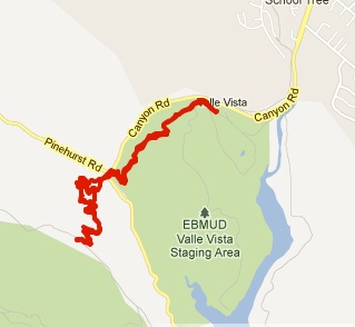
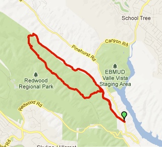
Length: 6.4 miles (can shorten to 4 mile loop)
Time: About 2.5 hours
Difficulty: Medium.
Dogs: Yes – on a leash
Calories:
Around 1000
Elevation Gain: 1,534 feet
Highlights: Redwood Regional Park is my favorite park in the East Bay, containing the largest remaining natural stand of coast redwood found in the East Bay. This shady loop offers a nice sampler of some of the best sections and trails in the park. The first half of the hike follows the Stream Trail with majestic redwoods along Redwood Creek. The second half traverses the scenic “uplands” of the park along the popular French Trail. This hike can be done in either direction.
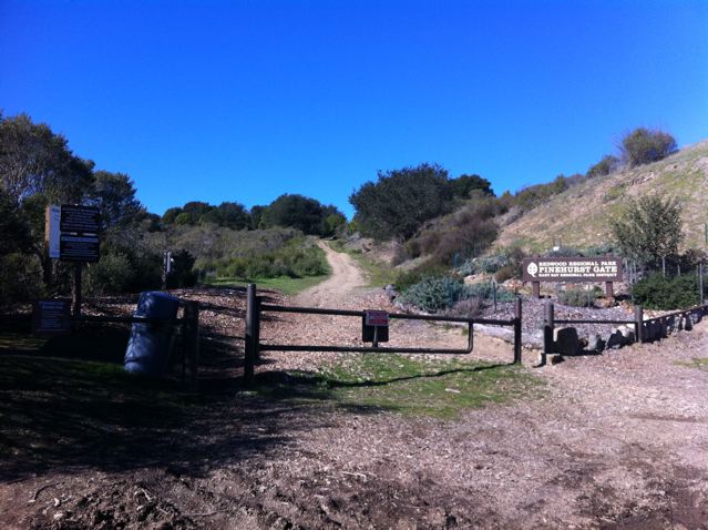
Directions: From Moraga take Canyon Road south until reaching Pinehurst. Take a left on Pinehurst and wind over the hill until reaching Redwood Road. Take a right. The park entrance will soon appear on your right. Park in the first parking lot on the left after you see the “Fishway” area and sign. $5 parking fee on weekends.
From the Oakland side take Highway 13 to the Carson Street/Redwood Road exit. Go East on Redwood Road for 3.2 miles until reaching the park entrance, passing Skyline Blvd on the way. Turn left into the park. Park in the first parking lot on the left after you see the “Fishway” area and sign. $5 parking fee on weekends.
Trailhead: The hike starts at the Fishway area.
Special Notes: There is quite a bit of poison oak along the French Trail so be careful or consider wearing long lightweight pants.
This hike isn’t technically in the Lamorinda area, but I figured I should write a post about it since I recommended it for an article in the Contra Costa Times titled “Bay Area’s best hiking trails” published on Sunday, July 6th, 2014.
View article…

Before starting your hike take a minute to check out the interpretive signs about Rainbow Trout. The world-famous rainbow trout were first identified as a distinct species from fish taken from San Leandro Creek drainage, of which Redwood Creek is a tributary. The trout that spawn in Redwood Creek today are descendants of that pure strain of native trout.


(Fishway interpretive area shown above)
Make sure to grab a map. Redwood Park is a maze of trails and it is very easy to take a wrong turn. So at each intersection double check the trail posts to ensure you’re going the right way. Link to park map…
To start the hike, cross the bridge and take a right on the Bridle Trail. Bridle Trail runs adjacent to Redwood Creek and bypasses the main parking lot and busy picnic areas. After about a half mile you may notice that the second group of redwood trees on the right appears to be in a circle (see picture). This is called a “fairy ring.” Redwoods sprout from the stumps or roots of existing trees. When the original tree dies, the surrounding shoots may develop into mature trees in a circle around the ancient parent. Try to imagine the old growth tree that would have been in the middle of the circle!

(Bridle Trail on left and a “Fairy Ring” of redwoods on the right)
You’ll reach a connector to the main Stream Trail, but you’ll want to stay left on the Bridle Trail. The trail will climb just a little and you’ll see the Stream Trail down to your right as you hike just above it. At one point there is an unmarked trail heading left, but you’ll want to go right and continue paralleling the Stream Trail. At about 1.5 miles The Bridle Trail will merge into Stream Trail (at the intersection with the Chown Trail).
Option for a 4 mile loop: After reaching the Stream Trail, go about a quarter mile and instead of going straight take a left on the Fern Trail, climb to the French Trail, and take a left. This will cut a little over 2 miles from the loop.

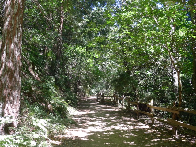
Stream Trail
For the full 6.4 mile loop continue on Stream Trail – the “spine” of the park. The largest redwoods along the creek are second and third growth descendants from a virgin, old-growth forest, just like Muir Woods, that was completely logged between 1840-1860, then logged again after the 1906 earthquake. So, the tallest trees are only about 100 years old. But that is long enough for many of them to have grown over 100 feet tall! Left undisturbed these amazing trees can live over 1000 years and grow to be over 300 feet tall.
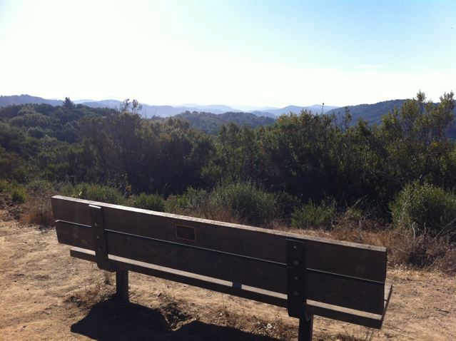
At a little over 2.5 miles you’ll reach the intersection with Tres Sendas Trail (translates from Spanish to three paths). This is one of the most scenic spots in the park. Take a left on Tres Sendas Trail and then take a break at the bench on the right, a perfect place to rest, have a snack, and take in the view.

Bench near intersection of Stream and Tres Sendas Trails
After just a tenth of a mile on the Tres Sendas Trail take a left on Starflower Trail. Get ready for one of the main climbing sections of the hike, but it’s only about a third of a mile. When you reach the French Trail, take a left.
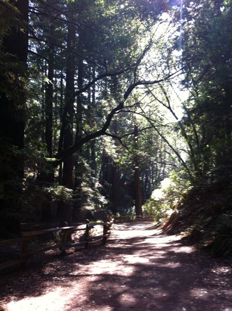
The French Trail winds along the western “uplands” of the park back in the direction you came. You’ll continue to see many redwoods, but also many California Bay Laurel trees and a few oak trees in the sunniest spots. When the French Trail intersects with the Chown Trail, make sure to follow the sign pointing left to stay on the French Trail.

Hiking along the French Trail
Along the French Trail and throughout the park, you’ll see ferns everywhere. This is an amazing family of plants. Ferns first appear in the fossil record 360 million years ago and now there are 12,000 different species of ferns. Ferns reproduce via spores and have neither seeds nor flowers. They tend to grow in areas where it is challenging for flowering plants to survive. You will see two types of ferns in the park: the western sword fern and the wood fern. See the picture of each type.


(Western Sword Fern on left, Wood Fern on right)
After about 2.7 miles on the French Trail, you’ll reach Orchard Trail. Take a left, descending back down to the Bridle Trail. Take a right at Bridle Trail and return to the Fishway area.
An interesting piece of history: when Alameda County was split off from Contra Costa County in 1853, the border was put right through the center of these redwood lands, because both counties realized the value of the forest and didn’t want to give it up.

There are an unlimited number of loops that you can create in Redwood Park. Just grab a map and plan a route from whatever staging area you start from.